Kirklees Way
Footpaths in West YorkshireLong-distance footpaths in EnglandProtected areas of West YorkshireTourist attractions in KirkleesUnited Kingdom road stubs ... and 3 more
United Kingdom trail stubsUse British English from January 2017West Yorkshire geography stubs

The Kirklees Way is a 72-mile (115 km) waymarked footpath in Kirklees metropolitan district, West Yorkshire, England. It was opened in 1990 and includes the upper Colne Valley, Spen Valley and Holme Valley. The Peak District Boundary Walk follows the Kirklees Way for a few miles either side of Holme.
Excerpt from the Wikipedia article Kirklees Way (License: CC BY-SA 3.0, Authors, Images).Kirklees Way
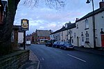
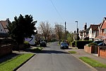
Station Road, Leeds Barwick in Elmet and Scholes
Geographical coordinates (GPS) Address Nearby Places Show on map
Geographical coordinates (GPS)
| Latitude | Longitude |
|---|---|
| N 53.825 ° | E -1.429 ° |
Address
Station Road
Station Road
LS15 4BU Leeds, Barwick in Elmet and Scholes
England, United Kingdom
Open on Google Maps


