Ill (Vorarlberg)
Austria river stubsBregenz Forest MountainsIll (Vorarlberg) basinRivers of AustriaRivers of Vorarlberg ... and 4 more
Silvretta AlpsTributaries of the RhineVerwall AlpsVorarlberg geography stubs

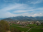
The Ill (all capitals: ILL) is a 72-kilometre-long (45 mi) tributary of the Rhine in the western Austrian state of Vorarlberg. It flows from the northern slopes of the Silvretta mountain range and then runs north-west through Vorarlberg. The Ill passes through the Montafon and Walgau valleys and the town Feldkirch. It joins the river Rhine a few kilometers northwest of Feldkirch ("Illspitz"), at the border with Switzerland. The Ill has several dams with hydroelectric power stations.
Excerpt from the Wikipedia article Ill (Vorarlberg) (License: CC BY-SA 3.0, Authors, Images).Ill (Vorarlberg)
Wiesendamm, Gemeinde Meiningen
Geographical coordinates (GPS) Address Website Nearby Places Show on map
Geographical coordinates (GPS)
| Latitude | Longitude |
|---|---|
| N 47.299166666667 ° | E 9.5586111111111 ° |
Address
Wiesendamm
6812 Gemeinde Meiningen
Vorarlberg, Austria
Open on Google Maps


