Castle, Bedford

Castle is an electoral ward and area of Bedford, Bedfordshire, England. The boundaries of Castle Ward are approximately Bromham Road and Goldington Road to the north, Denmark Street to the east, Rope Walk to the south, with the Midland Main Line railway line and Ashburnam Road to the west. Castle Ward includes almost all of Bedford town centre, as well as the eastern section of the Castle Road neighbourhood. Castle is the only Ward in the town of Bedford to be located on both sides of the River Great Ouse. In common usage the 'Castle' area is often synonymous with the Castle Road neighbourhood. Since local government boundary changes in Bedford in 2011, however, the Castle Road neighbourhood has been split between Castle Ward and Newnham Ward.
Excerpt from the Wikipedia article Castle, Bedford (License: CC BY-SA 3.0, Authors, Images).Castle, Bedford
Mill Street,
Geographical coordinates (GPS) Address Nearby Places Show on map
Geographical coordinates (GPS)
| Latitude | Longitude |
|---|---|
| N 52.13691 ° | E -0.46287 ° |
Address
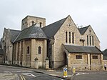
Church of the Sacred Heart of Jesus Christ and St Cuthbert
Mill Street
MK40 3EU , Castle
England, United Kingdom
Open on Google Maps


