Hong Kong Special Administrative Region of China of the People's Republic of China (HKSAR), can be geographically divided into three territories: Kowloon, Hong Kong Island, and the New Territories. Hong Kong is a coastal city and major port in Southern China, bordering Guangdong province through the city of Shenzhen to the north and the South China Sea to the west, east and south. Hong Kong and its 260 territorial islands and peninsulas are located at the mouth of the Pearl River Delta. The area of Hong Kong is distinct from Mainland China, but is considered part of "Greater China".
Hong Kong has a total area of 1,108 km2 (428 sq mi), of which 3.16% is water. 60 islands are dispersed around Hong Kong, the largest of which by area is Lantau Island, located southwest of the main peninsula. Lantau Island and the majority of the remaining islands are part of the New Territories, an area that also encompasses the hilly terrain north of Kowloon. Hong Kong Island is separated from Kowloon by Victoria Harbour, a natural landform harbour. The Kowloon Peninsula to the south of Boundary Street and the New Territories to the north of Hong Kong Island were added to Colonial Hong Kong in 1860 and 1898, respectively.
Further from Victoria Harbour and the coast, the landscape of Hong Kong is fairly hilly to mountainous with steep slopes. The highest point in the territory is Tai Mo Shan, at a height of 958 metres in the New Territories. Lowlands exist in the northwestern part of the New Territories. Portions of land in the New Territories and Hong Kong island are reserved as country parks and nature reserves.
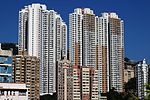
With the fourth highest population density of countries and dependencies in the world at 6,300 people per square kilometer, Hong Kong is known for its shortage of residential space. Hong Kong has undergone several land reclamation projects to provide more space for residential and economic purposes, increasing its land area. This has caused the distance between Hong Kong Island and Kowloon to decrease. Hong Kong International Airport is the sole public airport in the territory, and is mostly located on reclaimed land on the island of Chek Lap Kok.
Politically, Hong Kong is divided into 18 districts, each having a district council. Nevertheless, most public services operate across the territory, and travel between the districts is not restricted. Sha Tin is the most populous district as of 2019.
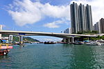
The name "Hong Kong", literally meaning "fragrant harbour", is derived from the area around present-day Aberdeen on Hong Kong Island, where fragrant wood products and incense were once traded. The narrow body of water separating Hong Kong Island and Kowloon Peninsula, Victoria Harbour, is one of the deepest natural maritime ports in the world.
Hong Kong is 60 km (37 mi) east of Macau, on the opposite side of the Pearl River estuary. Hong Kong and Macau are connected through the Hong Kong–Zhuhai–Macau Bridge.

 Continue reading on Wikipedia