Guide Bridge
Areas of Greater ManchesterAudenshawGeography of Tameside

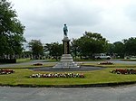
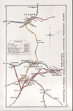
Guide Bridge is an area west of Ashton-under-Lyne, in Tameside, Greater Manchester, England. Historically part of Lancashire, Guide Bridge was built as a village around an eponymous bridge over the Ashton Canal.
Excerpt from the Wikipedia article Guide Bridge (License: CC BY-SA 3.0, Authors, Images).Guide Bridge
Guide Lane, Tameside Guide Bridge
Geographical coordinates (GPS) Address Nearby Places Show on map
Geographical coordinates (GPS)
| Latitude | Longitude |
|---|---|
| N 53.475 ° | E -2.114 ° |
Address
Guide Ln/Guide Bridge Station (Stop E)
Guide Lane
M34 5HF Tameside, Guide Bridge
England, United Kingdom
Open on Google Maps


