Everton, Nottinghamshire

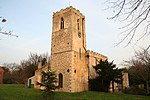
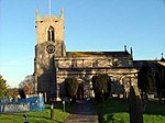
Everton is a village and civil parish in Nottinghamshire, England. Located on the A631 between Gainsborough and Bawtry, it is part of Bassetlaw district. The parish includes the village of Harwell. The population of the civil parish at the 2011 census was 839. There are 23 grade II listed buildings in the village. The village is recorded in the Domesday Book of 1086–7 as Evretone. Everton was originally a Danish settlement by the name of Eofor-tun. For the majority of its history Everton's inhabitants have been farmers. Everton is twinned with the French village of Bouy in Champagne Ardenne, France. Everton Mill was a four-storey brick tower windmill built c. 1820. It was sold along with a watermill to farmer James Taylor by Will Templence in 1848. The sails were removed in 1930, the mill being worked by steam engines installed in 1898 in a nearby engine house. The mill was still working in the 1940s but was closed c. 1950 and the machinery dismantled. The mill tower is still standing.
Excerpt from the Wikipedia article Everton, Nottinghamshire (License: CC BY-SA 3.0, Authors, Images).Everton, Nottinghamshire
Croft Lane, Bassetlaw
Geographical coordinates (GPS) Address Nearby Places Show on map
Geographical coordinates (GPS)
| Latitude | Longitude |
|---|---|
| N 53.414 ° | E -0.957 ° |
Address
Croft Lane
Croft Lane
DN10 5AZ Bassetlaw
England, United Kingdom
Open on Google Maps


