place

Żórawina

Villages in Wrocław CountyWrocław County geography stubs
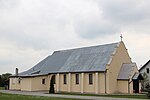
PL DS, pow. wrocławski, gm. Żórawina, Żórawina, ul. Niepodległości; Zespół kościoła par. pw. Św. Trójcy Kościół par. p.w. Św. Trójcy; A 1252 88; 04

Żórawina ([ʐuraˈvina]: German: Rothsürben, 1937–1947: Rothbach) is a village (former town) in Wrocław County, Lower Silesian Voivodeship, in south-western Poland. It is the seat of the administrative district (gmina) called Gmina Żórawina. The village lies approximately 16 kilometres (10 mi) south of the regional capital, which is Wrocław. Żórawina is the site of one of Poland's tallest radio masts, the Żórawina radio transmitter. There is a mass grave of 27 Polish, French, and Belgian prisoners of war murdered by the Germans in the village during World War II. The name of the village is of Polish origin and comes from the word żuraw 'crane'.

Excerpt from the Wikipedia article Żórawina (License: CC BY-SA 3.0, Authors, Images).

Żórawina
Kolejowa, gmina Żórawina

Geographical coordinates (GPS) Address Nearby Places
placeShow on map

Wikipedia: ŻórawinaContinue reading on Wikipedia

Geographical coordinates (GPS)

Latitude Longitude
N 50.983333333333 ° E 17.05 °
placeShow on map

Address

Żórawina

Kolejowa
55-020 gmina Żórawina
Lower Silesian Voivodeship, Poland
mapOpen on Google Maps

PL DS, pow. wrocławski, gm. Żórawina, Żórawina, ul. Niepodległości; Zespół kościoła par. pw. Św. Trójcy Kościół par. p.w. Św. Trójcy; A 1252 88; 04
Share experience

Nearby Places

Żórawina radio transmitter

The Żórawina radio transmitter is a facility for FM (and previously MW) transmission at Żórawina, south of Wrocław. It was established in 1932 as "Reichssender Breslau" and used as an antenna tower. Originally it was a 140-metre-tall free-standing lattice tower built of wood, on which a wire antenna was hung up. On the top of the tower there was an octagonal ring of bronze with a diameter of 10.6 metres for electrical lengthening of the antenna. In 1940 a second transmission aerial was built. It was an arrangement of three T-antennas mounted on three 49.9-metre-tall guyed masts, which formed a triangle with equal side length. This antenna and the wood tower were in use until the shutdown of the facility on February 7, 1945. After 1945 transmission was resumed by the Polish Broadcasting Company using the wood tower as an antenna tower. The frequency of the transmitter was changed to 1206 kHz in 1965. In 1976 a 260-metre-tall mast radiator was built at the site, with the radiated power increased to 200 kilowatts after its completion. The wood tower remained as a backup antenna until its demolition in fall 1990. Until its own demolition, the tower was the tallest wooden structure on earth after the demolition of the wooden radio tower of Transmitter Ismaning on March 16, 1983.In 1997 the MW transmitter was shut down. The guys of the mast, which were divided by insulators, were replaced with guys without insulators as the mast is now only used for FM- and TV-transmissions.