Czarny Bór
Lower Silesia geography stubsPages with Polish IPAVillages in Wałbrzych County

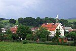
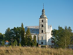
Czarny Bór (Polish: [ˈt͡ʂarnɨ ˈbur]) is a village in Wałbrzych County, Lower Silesian Voivodeship, in south-western Poland. It is the seat of the administrative district (gmina) called Gmina Czarny Bór. It lies approximately 11 kilometres (7 mi) west of Wałbrzych, and 76 kilometres (47 mi) south-west of the regional capital Wrocław.
Excerpt from the Wikipedia article Czarny Bór (License: CC BY-SA 3.0, Authors, Images).Czarny Bór
Główna, gmina Czarny Bór
Geographical coordinates (GPS) Address Nearby Places Show on map
Geographical coordinates (GPS)
| Latitude | Longitude |
|---|---|
| N 50.766666666667 ° | E 16.133333333333 ° |
Address
Główna 23C
58-379 gmina Czarny Bór
Lower Silesian Voivodeship, Poland
Open on Google Maps


