Saliha

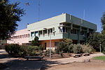
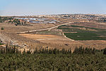
Saliha (Arabic: صَلْحَة), sometimes transliterated Salha, meaning 'the good/healthy place', was a Palestinian Arab village located 12 kilometres northwest of Safed. The Franco-British boundary agreement of 1920 placed Saliha within the French Mandate of Lebanon border, thus classifying it a part of Lebanese territory. It was one of the 24 villages transferred from the French mandate of Lebanon to British control in 1924 in accordance with the 1923 demarcation of the border between the Mandatory Palestine and the French Mandate for Syria and the Lebanon. It thus formed part of Palestine until 1948.Under the 1948 United Nations Partition Plan for Palestine, Saliha was to be included in the proposed Arab state, while the boundary between it and the proposed Jewish state was to run north of the built-up area of the village.During the 1948 Arab-Israeli war, Saliha was the site of a massacre carried out by Israeli forces shortly before the village was completely depopulated. The built structures in the village, with the exception of an elementary school for boys, were also destroyed.
Excerpt from the Wikipedia article Saliha (License: CC BY-SA 3.0, Authors, Images).Saliha
Galil Elyon Regional Council
Geographical coordinates (GPS) Address Nearby Places Show on map
Geographical coordinates (GPS)
| Latitude | Longitude |
|---|---|
| N 33.075555555556 ° | E 35.456111111111 ° |
Address
Galil Elyon Regional Council
North District, Israel
Open on Google Maps


