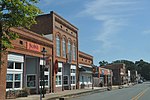
Waxhaws
Regions of North CarolinaRegions of South CarolinaUse mdy dates from July 2021
The Waxhaws is a geographical region extending beyond both sides of the border between what now is North Carolina and South Carolina, United States. It encompasses the areas currently known as Lancaster, Union and Mecklenburg counties. The name is derived from that of the Indigenous people who first inhabited the landbase, the Waxhaw people. Much of the area is now the territory of the Catawba Indian Nation.
Excerpt from the Wikipedia article Waxhaws (License: CC BY-SA 3.0, Authors).Waxhaws
McDonald Street,
Geographical coordinates (GPS) Address Nearby Places Show on map
Geographical coordinates (GPS)
| Latitude | Longitude |
|---|---|
| N 34.9259 ° | E -80.7459 ° |
Address
McDonald Street 318
28173
North Carolina, United States
Open on Google Maps


