place

Marshalsea Road

Charles DickensStreets in the London Borough of SouthwarkUse British English from June 2014
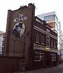
12 Marshalsea Road SE1 1HL geograph.org.uk 843859

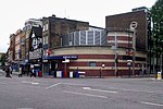
Marshalsea Road (classified A3201) is a major street in Southwark, south London, England. At the northwest end is the Southwark Bridge Road. At the southeast end is Borough tube station on Borough High Street. Continuing across the street are Long Lane and Great Dover Street. At the northeast corner is the historic St George the Martyr church, where the Charles Dickens character Little Dorrit was married in Dickens' book of the same name. The area around Marshalsea Road has many Dickens associations. Opposite Borough tube station, on the corner of Marshalsea Road and Borough High Street, is Brandon House. This is now the headquarters of Acas (the Advisory, Conciliation and Arbitration Service), an independent non-departmental public body of the UK Government for resolving industrial relations disputes.The Christian Medical Fellowship (CMF) is located at 6 Marshalsea Street and the Tara Bryan Gallery is at No 10.BCH Architects, specialists in church restoration projects and ecclesiastical architecture, are located at 16–18 Marshalsea Road.

Excerpt from the Wikipedia article Marshalsea Road (License: CC BY-SA 3.0, Authors, Images).

Marshalsea Road
Mint Street, London Borough (London Borough of Southwark)

Geographical coordinates (GPS) Address Nearby Places
placeShow on map

Wikipedia: Marshalsea RoadContinue reading on Wikipedia

Geographical coordinates (GPS)

Latitude Longitude
N 51.501944444444 ° E -0.095277777777778 °
placeShow on map

Address

Ilfracombe Flats

Mint Street 37-48
SE1 1JW London, Borough (London Borough of Southwark)
England, United Kingdom
mapOpen on Google Maps

12 Marshalsea Road SE1 1HL geograph.org.uk 843859
Share experience

Nearby Places

Suffolk Place
Suffolk Place

Suffolk Place (or Suffolk House) was a mansion house located on the west side of Borough High Street in Southwark, Surrey, on the south bank of the River Thames opposite the City of London. It was the London town house of the Dukes of Suffolk, and was located near Winchester Palace, London seat of the Bishop of Winchester. The position was highly prominent as Borough High Street (or Southwark Street) was the principal thoroughfare leading from London Bridge and the City of London, to Canterbury and Dover, a route used by monarchs and others, including the pilgrims in Chaucer's Canterbury Tales. It was built in the fifteenth century and rebuilt in fine Renaissance style in 1522 by Charles Brandon, 1st Duke of Suffolk (c.1484-1545) a favourite of King Henry VIII. On 4 February 1536 it was taken over by King Henry VIII who exchanged it with Brandon for Norwich Place on the Strand, on the north side of the Thames, nearer to the Palace of Westminster. King Henry VIII granted it to his wife Jane Seymour in June 1537, but when she died the following October, it reverted to the King. In 1545 the house was converted into a mint. It was occupied by Queen Mary I (1553-1558) and her new husband Philip II of Spain on the night before their state entry into London in 1554. This was possibly the time when it was depicted by Anthony van den Wyngaerde in his Panorama of London, to the left of Borough High Street in the foreground of the picture. It was demolished in 1557 and the area was built over with small tenements, which became known as The Mint, a notorious rookery. A modern office block called Brandon House at 180 Borough High Street (opposite Borough tube station) now occupies the site of Suffolk Place. It is also memorialised by nearby Suffolk Street.