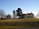
Webhannet River

The Webhannet River is an 8.3-mile-long (13.4 km) river whose 8,963-acre (36.27 km2) watershed is contained entirely within the town of Wells, Maine.The river has five tributaries, including three with official names: Pope’s Creek, Depot Brook, and Blacksmith Brook. Draining a sandy outwash plain left by the last glacier, they run parallel to the southern Maine coastline behind the heavily developed barrier beaches of Wells and Drakes Island. The river flows into Wells Harbor, then empties between a pair of jetties into the Gulf of Maine.The Webhannet watershed includes 1,510 acres (6.1 km2) of land under conservation, including 1,167 acres (4.72 km2) of estuary salt marsh and uplands protected by the Rachel Carson National Wildlife Refuge.
Excerpt from the Wikipedia article Webhannet River (License: CC BY-SA 3.0, Authors, Images).Webhannet River
Everett Lane,
Geographical coordinates (GPS) Address Nearby Places Show on map
Geographical coordinates (GPS)
| Latitude | Longitude |
|---|---|
| N 43.315624 ° | E -70.564756 ° |
Address
Everett Lane 21
04090
Maine, United States
Open on Google Maps


