Burke Mountain (Vermont)

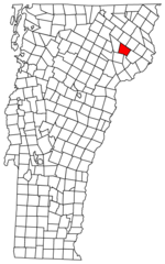
Burke Mountain is a mountain located in the Northeast Kingdom of Vermont. The bulk of the mountain is in Burke and Kirby, Caledonia County, but its southeast side is in Essex County. It is flanked to the east and southeast by Umpire Mountain and Kirby Mountain, respectively. Burke Mountain stands within the watershed of the Passumpsic River. The northeast and northwest sides of Burke Mountain drain into Dish Mill Brook, thence into the East Branch of the Passumpsic River. The southwest end of Burke Mtn. drains into Mountain Brook, thence into the East Branch of the Passumpsic River. The south slopes and southeast side of Burke Mountain drain into Weir Mill Brook, thence into Bog Brook, the Moose River, and the Passumpsic River. It is within the Darling State Forest Park of Victory State Forest. The Burke Mountain Ski Area has been developed since the 1940s on the northwest slopes of the mountain. Burke Mountain was purchased by the owners of Jay Peak Resort in Jay, Vermont in 2012.
Excerpt from the Wikipedia article Burke Mountain (Vermont) (License: CC BY-SA 3.0, Authors, Images).Burke Mountain (Vermont)
Profile Trail, Burke
Geographical coordinates (GPS) Address Nearby Places Show on map
Geographical coordinates (GPS)
| Latitude | Longitude |
|---|---|
| N 44.570833333333 ° | E -71.893166666667 ° |
Address
WVTB-TV (Saint Johnsbury)
Profile Trail
05832 Burke
Vermont, United States
Open on Google Maps


