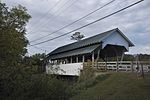
Burrington Covered Bridge
Buildings and structures in Lyndon, VermontCovered bridges in Caledonia County, VermontCovered bridges on the National Register of Historic Places in VermontNational Register of Historic Places in Caledonia County, VermontQueen post truss bridges in the United States ... and 2 more
Road bridges in VermontWooden bridges in Vermont

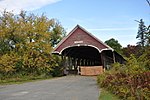
The Burrington Covered Bridge is a historic queenpost truss covered bridge in Lyndon, Vermont. Built in the 19th century, it is one of five covered bridges in Lyndon. It formerly carried Burrington Bridge Road across the Passumpsic River; it has been bypassed by a modern bridge. It was listed on the National Register of Historic Places in 1974.
Excerpt from the Wikipedia article Burrington Covered Bridge (License: CC BY-SA 3.0, Authors, Images).Burrington Covered Bridge
Burrington Bridge Road,
Geographical coordinates (GPS) Address External links Nearby Places Show on map
Geographical coordinates (GPS)
| Latitude | Longitude |
|---|---|
| N 44.553611111111 ° | E -71.97 ° |
Address
Randal Bridge
Burrington Bridge Road
Vermont, United States
Open on Google Maps


