Leiper's Fork, Tennessee
AC with 0 elementsAccuracy disputes from March 2022Historic districts on the National Register of Historic Places in TennesseeNRHP infobox with nocatNatchez Trace ... and 3 more
National Register of Historic Places in Williamson County, TennesseeUnincorporated communities in TennesseeUnincorporated communities in Williamson County, Tennessee

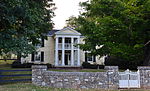
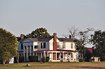
Leiper's Fork (also spelled Leipers Fork) is an unincorporated rural village in Williamson County, Tennessee. It has a population of about 650 on an area of about 1,100 acres (450 ha). Most of the village shares a ZIP code with Franklin. The village, located on the Natchez Trace Parkway, is listed on the National Register of Historic Places as an historic district.
Excerpt from the Wikipedia article Leiper's Fork, Tennessee (License: CC BY-SA 3.0, Authors, Images).Leiper's Fork, Tennessee
Lockwood Ridge Lane,
Geographical coordinates (GPS) Address Nearby Places Show on map
 Continue reading on Wikipedia
 Geographical coordinates (GPS)
| Latitude | Longitude |
|---|---|
| N 35.9175 ° | E -86.975277777778 ° |
Address
Lockwood Ridge Lane
Lockwood Ridge Lane
Tennessee, United States
Open on Google Maps