place

Bishop Wilton Wold

Aviation accidents and incidents locations in EnglandEast Riding of Yorkshire geography stubsHighest points of English countiesLandforms of the East Riding of YorkshireMarilyns of England
Use British English from April 2023Yorkshire Wolds
Garrowby Hill tumulus

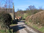
Bishop Wilton Wold is the highest point of the Yorkshire Wolds in the East Riding of Yorkshire, England. The summit, known as Garrowby Hill, lies about five miles (eight kilometres) north of Pocklington. As with most of the wolds, it is wide, flat and agricultural in nature. The A166 road passes right by the top. However, it is a Marilyn (having topographic prominence of at least 150 m or 492 ft 2 in). There is a trig point, two covered reservoirs and an aerial. Topography detailed from LIDAR info, in the database of British Hills, gives the summit as 247.9 metres (813 ft) on the tumulus north of the A166 road just to the east of the 246-metre (807 ft) OS map height given for the triangulation pillar that is within the reservoir. The prominence is 207.2m with col of 40.7m at TA 1103 7869 as detailed in the database of British Hills. The British artist David Hockney painted the view from the summit in 1998.

Excerpt from the Wikipedia article Bishop Wilton Wold (License: CC BY-SA 3.0, Authors, Images).

Bishop Wilton Wold
Garrowby Hill,

Geographical coordinates (GPS) Address Nearby Places
placeShow on map

Wikipedia: Bishop Wilton WoldContinue reading on Wikipedia

Geographical coordinates (GPS)

Latitude Longitude
N 54.00163 ° E -0.75049 °
placeShow on map

Address

Garrowby Hill

Garrowby Hill
YO42 1TE , Bishop Wilton
England, United Kingdom
mapOpen on Google Maps

Garrowby Hill tumulus
Share experience

Nearby Places

Millington, East Riding of Yorkshire

Millington is a small village and civil parish in the East Riding of Yorkshire, England. It is situated approximately 2 miles (3.2 km) north-east of Pocklington. The civil parish is formed by the village of Millington and the hamlets of Great Givendale and Ousethorpe. According to the 2011 UK census, Millington parish had a population of 242, an increase on the 2001 UK census figure of 217. Nearby is Millington Woods and Millington Pastures. Millington Woods is one of the few remaining wooded dales in the Yorkshire Wolds. The woods includes Millington Springs, which formerly supported beds of watercress. Millington Pastures holds a stock of highland cattle, and is used for bike riding and walking. The church dedicated to St Margaret was designated a Grade I listed building in 1967 and is now recorded in the National Heritage List for England, maintained by Historic England. Millington has a public house called The Gait Inn and also a licensed restaurant and tea room called The Ramblers Rest. The Yorkshire Wolds Way National Trail, a long distance footpath passes through the parish, to the east of the village. In 1823 Millington was a village and civil parish in the Wapentake of Harthill and the Liberty of St Peter's. The ecclesiastical parish living was under the patronage of the Dean of York. Population at the time was 282. Occupations included three farmers, a blacksmith, a wheelwright, a corn miller, a shopkeeper, and the landlord of The Gate public house. Resident were a school master, the parish vicar, and a gentleman.

Yapham
Yapham

Yapham is a village and civil parish in the East Riding of Yorkshire, Northern England. It is situated about 2 miles (3.2 km) north-east of Pocklington. The parish includes the hamlet of Meltonby and is approximately 1,830 acres (740 ha).The village was originally known as Iapun / Lapun and the first reference of the village can be found in the Domesday Book (1086). The village was later known as Yapome with further references in Ancient Petitions, Henry III – James I (1390) when William Lokton petitioned the King for the restoration of the manor of Bolton and other property in Yapome (Yapham). It is not known when the current spelling of the name was adopted. The village Church, St Martin's, is a small church was partially rebuilt in 1777–8. It consists of chancel and nave, with a western turret, containing one bell. The church was designated a Grade II* listed building in 1967 and is now recorded in the National Heritage List for England, maintained by Historic England. The Wesleyans built a chapel in 1865 however this has been converted into a private house in the 1980s. A school has served the village and surrounding area since before 1773 with a new school built in 1875 to accommodate up to 45 children. The school closed in 1972 with the remaining children transferring to St Martin's Church of England Voluntary Aided Primary School in Fangfoss. The old school buildings are now used as a village hall. Yapham was served by Yapham Gate railway station on the York–Beverley line for a short while between 1855 and 1865. The population of Yapham has remained reasonably unchanged for many years with the 1891 UK census identifying a population of 191 with the 2001 UK census identifying a population of 175. Since 2001, however there have been a number of new houses built in the village. The population of the civil parish at the 2011 Census was shown as 217. Although the civil parish is called "Yapham" its parish council is called "Yapham cum Meltonby Parish Council".Yapham was formerly a township and chapelry in the parish of Pocklington, in 1866 it became a civil parish as Yapham cum Meltonby, on 1 April 1935 the parish was renamed to "Yapham".Yapham Cricket Club has been playing at the Cricket Ground on the edge of the village for almost 100 years and is one of only a few clubs to play on through the war. The club now has a strong junior section as well as both Men's and Ladies Senior Teams. The Gravel Pit Allotment Association was formed in 2009 to convert the old gravel pit field in between Yapham and Meltonby into community allotments.