place

Kilnwick Percy

East Riding of Yorkshire geography stubsFormer civil parishes in the East Riding of YorkshireOpenDomesdayUse British English from December 2014Villages in the East Riding of Yorkshire
St Helens Church Kilnwick Percy 1

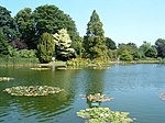
Kilnwick Percy is a village and former civil parish, now in the parish of Nunburnholme, in the East Riding of Yorkshire, England. It is situated approximately 1.5 miles (2.4 km) north-east of Pocklington town centre, and to the north of the B1246 road. In 1931 the parish had a population of 69. On 1 April 1935 the parish was abolished and merged with Nunburnholme.Kilnwick Percy Hall is a Grade II* listed country house built around 1845. It is now a Buddhist meditation and retreat centre. The grounds of the hall include a lake and a small church in the Norman style dedicated to Saint Helen. The church is designated a Grade II listed building and is now recorded in the National Heritage List for England, maintained by Historic England.In 1823 Kilnwick Percy was a civil parish in the Wapentake and Liberty of Holderness. The ecclesiastical parish was under the patronage of the Dean of York. Population at the time was 43.

Excerpt from the Wikipedia article Kilnwick Percy (License: CC BY-SA 3.0, Authors, Images).

Kilnwick Percy
Kilnwick Road,

Geographical coordinates (GPS) Address Nearby Places
placeShow on map

Wikipedia: Kilnwick PercyContinue reading on Wikipedia

Geographical coordinates (GPS)

Latitude Longitude
N 53.939986 ° E -0.743492 °
placeShow on map

Address

Madhyamaka Buddhist Centre

Kilnwick Road
YO42 1UF , Nunburnholme
England, United Kingdom
mapOpen on Google Maps

St Helens Church Kilnwick Percy 1
Share experience

Nearby Places

Millington, East Riding of Yorkshire

Millington is a small village and civil parish in the East Riding of Yorkshire, England. It is situated approximately 2 miles (3.2 km) north-east of Pocklington. The civil parish is formed by the village of Millington and the hamlets of Great Givendale and Ousethorpe. According to the 2011 UK census, Millington parish had a population of 242, an increase on the 2001 UK census figure of 217. Nearby is Millington Woods and Millington Pastures. Millington Woods is one of the few remaining wooded dales in the Yorkshire Wolds. The woods includes Millington Springs, which formerly supported beds of watercress. Millington Pastures holds a stock of highland cattle, and is used for bike riding and walking. The church dedicated to St Margaret was designated a Grade I listed building in 1967 and is now recorded in the National Heritage List for England, maintained by Historic England. Millington has a public house called The Gait Inn and also a licensed restaurant and tea room called The Ramblers Rest. The Yorkshire Wolds Way National Trail, a long distance footpath passes through the parish, to the east of the village. In 1823 Millington was a village and civil parish in the Wapentake of Harthill and the Liberty of St Peter's. The ecclesiastical parish living was under the patronage of the Dean of York. Population at the time was 282. Occupations included three farmers, a blacksmith, a wheelwright, a corn miller, a shopkeeper, and the landlord of The Gate public house. Resident were a school master, the parish vicar, and a gentleman.