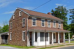
Conewago Canal

The Conewago Canal, on the west bank of the Susquehanna River below York Haven, Pennsylvania, 11 miles (18 km) south of Harrisburg in York County, enabled late 18th and early 19th century rivercraft to safely bypass rapids at Conewago Falls. Work on the canal of less than 1 mile (1.6 km) began in 1793 and was completed in 1797. Robert Morris, a Philadelphia financier, organized the project, which was carried out by chief engineer James Brindley, the nephew of a well-known British engineer of the same name. Two lift locks overcame 19 feet (6 m) of elevation between the ends of the canal, and a guard lock blocked unwanted water, particularly during floods. Cargo could go upstream as well as down. A boat going upriver could navigate the canal in 37 minutes compared to the whole day it would take 30 or 40 men to pull it upriver along the bank. York Haven is at 40°06′39″N 76°42′57″W.Despite the canal, flow variations limited the use of the river for shipping to a few months each year. In addition, river boat captains disliked paying the toll required to use the privately owned canal. River arks, a kind of boat less susceptible to damage from rocks in the rapids, made it possible to run the rapids and avoid the toll. The Eastern Division of the Pennsylvania Canal, which ran between Columbia and the mouth of the Juniata River, later bypassed this same section of the river.
Excerpt from the Wikipedia article Conewago Canal (License: CC BY-SA 3.0, Authors, Images).Conewago Canal
Allée Saint-Denis, Paris Paris 16e Arrondissement (Paris)
Geographical coordinates (GPS) Address Nearby Places Show on map
Geographical coordinates (GPS)
| Latitude | Longitude |
|---|---|
| N 40.110833333333 ° | E -76.715833333333 ° |
Address
Allée Saint-Denis
Allée Saint-Denis
75116 Paris, Paris 16e Arrondissement (Paris)
Île-de-France, France
Open on Google Maps


