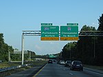
Norfolk County, Virginia

Norfolk County was a county of the South Hampton Roads in eastern Virginia in the United States that was created in 1691. After the American Civil War, for a period of about 100 years, portions of Norfolk County were lost and the territory of the county reduced as they were annexed by the independent and growing cities of Norfolk, Portsmouth and South Norfolk. In 1963, voters approved by referendum in two jurisdictions to consolidate the remaining portions of Norfolk County with the much smaller city of South Norfolk; they chose the name city of Chesapeake for the new independent city. Although organized as a city, and one of the larger in Virginia, Chesapeake has both busy suburban and industrial areas, and mostly rural sections. The latter includes a large portion of the Great Dismal Swamp and large tracts of preserved forest land.
Excerpt from the Wikipedia article Norfolk County, Virginia (License: CC BY-SA 3.0, Authors, Images).Norfolk County, Virginia
Portsmouth Boulevard, Suffolk
Geographical coordinates (GPS) Address Nearby Places Show on map
Geographical coordinates (GPS)
| Latitude | Longitude |
|---|---|
| N 36.7706 ° | E -76.4644 ° |
Address
Portsmouth Boulevard
Portsmouth Boulevard
Suffolk
Virginia, United States
Open on Google Maps


