place

Three Rivers State Park

1955 establishments in FloridaBodies of water of Jackson County, FloridaFlorida Panhandle geography stubsFlorida state park stubsParks in Jackson County, Florida
Protected areas established in 1955Rivers of FloridaState parks of FloridaUse mdy dates from August 2023
3RivStPkLkSmnl2008
3RivStPkLkSmnl2008

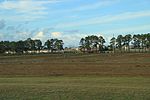
Three Rivers State Park is a Florida State Park located north of Sneads, on the shores of Lake Seminole near the Georgia border, in northwestern Florida. It is named for the main rivers associated with Lake Seminole: the Chattahoochee and the Flint (which flow into it from Georgia), and the Apalachicola (whose source is the lake itself.) The address is 7908 Three Rivers Park Road.

Excerpt from the Wikipedia article Three Rivers State Park (License: CC BY-SA 3.0, Authors, Images).

Three Rivers State Park
River Road,

Geographical coordinates (GPS) Address Nearby Places
placeShow on map

Wikipedia: Three Rivers State ParkContinue reading on Wikipedia

Geographical coordinates (GPS)

Latitude Longitude
N 30.739836 ° E -84.934869 °
placeShow on map

Address

River Road

River Road
32460
Florida, United States
mapOpen on Google Maps

3RivStPkLkSmnl2008
3RivStPkLkSmnl2008
Share experience

Nearby Places

Nicolls' Outpost

Nicolls' Outpost was the smaller and more northern of two forts built by British Lt. Col. Edward Nicolls during the War of 1812. (The Americans referred to it as Fort Apalachicola. Built at the end of 1814, together with the larger "British post" or storage depot down the Apalachicola,: 47  it was "the northernmost post built by the British during their Gulf Coast Campaign". It was just below the Spanish Florida–Georgia border, where the Flint and Chattahoochee Rivers meet to form the Apalachicola, in River Landing Park in modern Chattahoochee, Florida. Even though what was built was smaller than the much larger British post down the Apalachicola, it was intended to be the base, presumably enlarged, for an English invasion of the United States, and British post was to have been its supply depot. The 1815 end of the War of 1812 aborted this project. It was built atop the largest of three surviving mounds of the prehistoric Fort Walton culture. Above the winter flood stage of the Apalachicola, it could reach both forks of the river with cannon fire. It was built in 1814 and abandoned early in 1815, at the end of the war. It was armed with a 5+1⁄2-inch howitzer. It also had a coehorn, a mortar that could fire 24-pound shells. According to a report of U.S. Colonel and Indian agent Benjamin Hawkins, there were "200 troops white and black and an assemblage of 500 [Creek] Warriors", "well supplied with cloth[e]s and munitions of War". The intention was to mount an expedition "up the river" (the Flint), bringing the cannon along.: 76  Georgia militia, other U.S. forces, and the faction of the Creek allied with the U.S. (the Lower Creeks) were preparing upriver (in Georgia) for a battle. News of the treaty ending the war (Treaty of Ghent), which reached both sides in February 1815, prevented the battle from taking place. The British abandoned both of its forts on the Apalachicola, leaving them in the hands of the black Corps of Colonial Marines that Nicolls had trained, and of Red Stick Creek Neamathla and his warriors.