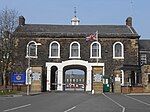
Brookfield, Preston

Brookfield is an electoral ward of the city of Preston, in Lancashire, England. It is located north-east of the city centre, in the suburb of Ribbleton. At the 2001 census the ward had a population of 7,625, reducing to 7,301 at the 2011 Census. The area is represented on the city council by three Labour councillors. The area forms part of the Preston East division of Lancashire County Council, represented by one Labour councillor. The area is mainly residential, and the majority of homes are privately owned although there is also a large council estate. The ward also contains a modern business park, which includes the head office of Booths, a regional chain of supermarkets. This is close to junction 31A on the M6 motorway.
Excerpt from the Wikipedia article Brookfield, Preston (License: CC BY-SA 3.0, Authors, Images).Brookfield, Preston
Burnsall Place, Preston Ribbleton
Geographical coordinates (GPS) Address Nearby Places Show on map
Geographical coordinates (GPS)
| Latitude | Longitude |
|---|---|
| N 53.782 ° | E -2.666 ° |
Address
Burnsall Place
Burnsall Place
PR2 6UE Preston, Ribbleton
England, United Kingdom
Open on Google Maps


