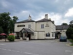
Wervin
Cheshire geography stubsCivil parishes in CheshireUse British English from February 2021Villages in Cheshire

Wervin is a small village and civil parish in the unitary authority of Cheshire West and Chester and the ceremonial county of Cheshire, England. It is situated between Chester and Ellesmere Port, near the Shropshire Union Canal and the M53 motorway.
Excerpt from the Wikipedia article Wervin (License: CC BY-SA 3.0, Authors, Images).Wervin
Ashwood Lane,
Geographical coordinates (GPS) Address Nearby Places Show on map
Geographical coordinates (GPS)
| Latitude | Longitude |
|---|---|
| N 53.241 ° | E -2.866 ° |
Address
Ashwood Lane
Ashwood Lane
CH2 4BY
England, United Kingdom
Open on Google Maps


