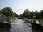
Culham
Civil parishes in OxfordshirePopulated places on the River ThamesSouth Oxfordshire DistrictUse British English from August 2015Villages in Oxfordshire

Culham is a village and civil parish in a bend of the River Thames, 1 mile (1.6 km) south of Abingdon in Oxfordshire. The parish includes Culham Science Centre and Europa School UK (formerly the European School, Culham, which was the only Accredited European School within the United Kingdom). The parish is bounded by the Thames to the north, west and south, and by present and former field boundaries to the east. It is low-lying and fairly flat, rising from the Thames floodplain in the south to a north-facing escarpment in the north up to 260 feet (80 m) above sea level. The 2011 Census recorded its population as 453.
Excerpt from the Wikipedia article Culham (License: CC BY-SA 3.0, Authors, Images).Culham
Tollgate Road, South Oxfordshire Culham
Geographical coordinates (GPS) Address Nearby Places Show on map
Geographical coordinates (GPS)
| Latitude | Longitude |
|---|---|
| N 51.652 ° | E -1.266 ° |
Address
Tollgate Road
Tollgate Road
OX14 4NL South Oxfordshire, Culham
England, United Kingdom
Open on Google Maps


