Ronkswood
Geography of Worcester, England

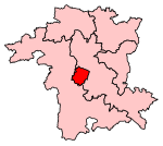
Ronkswood is a suburb of the city of Worcester, the county seat of Worcestershire, England. It is around one mile east of the city centre, centred on Newtown Road (B4636). Much of the Ronkswood housing estate was built in the late 1940s.
Excerpt from the Wikipedia article Ronkswood (License: CC BY-SA 3.0, Authors, Images).Ronkswood
Newtown Road, Worcester, England The Ronkswood
Geographical coordinates (GPS) Address Nearby Places Show on map
Geographical coordinates (GPS)
| Latitude | Longitude |
|---|---|
| N 52.194389 ° | E -2.195678 ° |
Address
Newtown Road
Newtown Road
WR5 1JL Worcester, England, The Ronkswood
England, United Kingdom
Open on Google Maps


