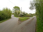
place

Long Lawford

Borough of RugbyVillages in Warwickshire
Main Street, Long Lawford 7.20

Long Lawford is a village and civil parish in the Rugby borough of Warwickshire, England, located just west of Rugby, around 1.75 miles (2.82 km) west of Rugby town centre. In the 2021 census, the population of the parish was 4,545, a significant increase from 3,180 at the 2011 census, and 2,863 in 2001.

Excerpt from the Wikipedia article Long Lawford (License: CC BY-SA 3.0, Authors, Images).

Long Lawford
Townsend Lane,

Geographical coordinates (GPS) Address Nearby Places
placeShow on map

Wikipedia: Long LawfordContinue reading on Wikipedia

Geographical coordinates (GPS)

Latitude Longitude
N 52.379465 ° E -1.30276 °
placeShow on map

Address

Townsend Lane

Townsend Lane
CV23 9SZ , Long Lawford
England, United Kingdom
mapOpen on Google Maps

Main Street, Long Lawford 7.20
Share experience

Nearby Places

Cawston, Warwickshire

Cawston is a civil parish and suburban village close to the south west of Rugby, on the A4071 (which is in turn just one mile from the M45). The population of the civil parish at the 2011 census was 3,234. For hundreds of years the village was basically a hamlet and the two settlements remained separate despite Rugby's continued growth. However, in 2003-04 a new housing development, Cawston Grange, was completed all but connecting the two settlements. Cawston Grange Primary School was built at the same time to educate children in the area aged 4–11 and there is a nursery for pre-school children, as well as a public house and shops. One of the most significant older buildings in the village is Cawston House. It was built in 1545 by Edward Boughton. The house has been in the hands of several notable titled families and was also used as a convalescent home for troops from Belgium in World War I, a girls' school between 1938 and 1958, and a research and development unit for an engineering company. The house was greatly altered in 1907 and remains the same externally to this day. In 2004 the house was bought by a developer and sub-divided to make a retirement village. The old Rugby to Leamington railway line ran through the old village (this closure predates the Beeching cuts, but part was still used as a freight line to Rugby Cement works at Long Itchington) and its path can still be walked along. The railway bridge over the A4071 has in recent years gained minor fame for the 'witty' slogans written on it. Examples of such (referring to a different village near Rugby) are "Home rule for Crick" and "Fly Crick air". In August 2007 construction of the Rugby Western Relief Road started just west of the village, a project which was completed in 2010.

Newbold-on-Avon
Newbold-on-Avon

Newbold-on-Avon (usually shortened to just Newbold) is a suburb of Rugby in Warwickshire, England, located around 1½ miles north-west of the town centre, it is adjacent to the River Avon from which the suffix is derived. Newbold was historically a village in its own right, but was incorporated into Rugby in 1932. The name is derived from the Saxon Niowebold ('New house').The ancient parish of Newbold-on-Avon contained the nearby settlements of Harborough Parva, Cosford, Long Lawford and Little Lawford. The latter three became separate civil parishes in the 19th century, while Harborough Parva was transferred to Harborough Magna parish in 1931. In 1931 the parish had a population of 696. On 1 April 1932 the parish was abolished and merged with Rugby and Harborough Magna.The older part of the village of Newbold sits on a hill north of the River Avon on the B4112 road, and contains some old buildings, including some red brick 18th-century houses and some timber-framed buildings from the 17th century. The church of St Botolph in the old village dates from the 15th century, and is grade I listed and stands on the site of an earlier church. Newbold grew considerably during the 20th century, with a number of modern housing and industrial estates having been built to the east of the old village at the foot of the hill, around the Avon valley.The Oxford Canal runs immediately to the north of Newbold, here it runs through the 250-metre-long Newbold Tunnel. This tunnel was built in 1829 as part of a scheme to straighten out the winding canal, and it replaced an older tunnel which dated from 1777 on the original route, which ran at a right-angle to the newer tunnel. The southern portal of the abandoned tunnel can be seen next to the churchyard, it is now bricked up but with two holes to allow for bats to enter. There is a canalside pub at Newbold, the Barley Mow (a second one The Boat having now closed). There is also another pub called the Newbold Crown closer to the centre of the village.There are some former limestone quarries in the Newbold area. One of them has been converted into a nature reserve, known as Newbold Quarry Park. Another park named Newbold Centenary Park opened in 2016 off Parkfield Road: built on the site of former allotments, it was so named to mark the centenary of the First World War.The main secondary school in Newbold is the Avon Valley School, which was formerly known as Newbold Grange High School until the early-1990s. Newbold is home to Newbold-on-Avon RFC.