Ongar Rural District
Borough of BrentwoodDistricts of England created by the Local Government Act 1894Epping Forest DistrictEssex geography stubsPolitical history of Essex ... and 2 more
Rural districts of EnglandUse British English from August 2012

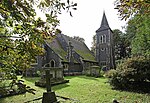
Ongar Rural District was a local government district in Essex, England from 1894 to 1955. It included the small town of Chipping Ongar and the parishes surrounding it. It was abolished in 1955 and combined with part of Epping Rural District to create Epping and Ongar Rural District.
Excerpt from the Wikipedia article Ongar Rural District (License: CC BY-SA 3.0, Authors, Images).Ongar Rural District
Long Fields, Epping Forest Ongar
Geographical coordinates (GPS) Address Nearby Places Show on map
Geographical coordinates (GPS)
| Latitude | Longitude |
|---|---|
| N 51.7 ° | E 0.25 ° |
Address
Long Fields
Long Fields
CM5 9DE Epping Forest, Ongar
England, United Kingdom
Open on Google Maps


