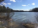
Colonial Parkway

Colonial Parkway is a 23-mile (37 km) scenic parkway linking the three points of Virginia's Historic Triangle, Jamestown, Williamsburg, and Yorktown. It is part of the National Park Service's Colonial National Historical Park. Virginia's official state classification for the parkway is State Route 90003. With portions built between 1930 and 1957, it links the three communities via a roadway shielded from views of commercial development. The roadway is toll-free, is free of semi trucks, and has speed limits of around 35 to 45 mph (55 to 70 km/h). As a National Scenic Byway and All-American Road (one of only 31 in the U.S.), it is also popular with tourists due to the James River and York River ends of the parkway.
Excerpt from the Wikipedia article Colonial Parkway (License: CC BY-SA 3.0, Authors, Images).Colonial Parkway
Colonial Parkway,
Geographical coordinates (GPS) Address External links Nearby Places Show on map
Geographical coordinates (GPS)
| Latitude | Longitude |
|---|---|
| N 37.21557 ° | E -76.71581 ° |
Address
Colonial Parkway
Colonial Parkway
23815
Virginia, United States
Open on Google Maps


