place

Assembly Square

Buildings and structures in Somerville, MassachusettsMystic RiverNeighborhoods in Somerville, MassachusettsPopulated places in Middlesex County, MassachusettsSquares in Somerville, Massachusetts
Transit-oriented developments in the United States
SomervilleMA AssemblySquareMarketplaceSign

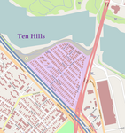
Assembly Square is a neighborhood in Somerville, Massachusetts. It is located along the west bank of the Mystic River, bordered by Ten Hills and Massachusetts Route 28 to the north and the Charlestown neighborhood of Boston to the south. The district's western border runs along Interstate 93. Located 2.5 mi (4.0 km) from downtown Boston, the 143 acres (580,000 m2) parcel is named for a former Ford Motor Company plant that closed in 1958.The area is home to Assembly Row, a 45-acre (180,000 m2) mixed-use, smart growth development that broke ground in April 2012 and opened 2014. It includes retail outlets, restaurants, residential space, office and research and development space, a 12-screen cinema and a 200-room hotel. Other amenities include a marina, revitalized waterfront park, bike paths and other green space. Assembly Row's first stage of development was the Assembly Square Marketplace. Completed in 2006, the marketplace is a "power center" that comprises retail stores Christmas Tree Shops, Burlington, Trader Joe's, Staples, TJMaxx, and Bed Bath & Beyond.The area is served by the MBTA Orange Line at Assembly station.

Excerpt from the Wikipedia article Assembly Square (License: CC BY-SA 3.0, Authors, Images).

Assembly Square
Grand Union Boulevard, Somerville

Geographical coordinates (GPS) Address Nearby Places
placeShow on map

Wikipedia: Assembly SquareContinue reading on Wikipedia

Geographical coordinates (GPS)

Latitude Longitude
N 42.393055555556 ° E -71.080555555556 °
placeShow on map

Address

Grand Union Boulevard

Grand Union Boulevard
02145 Somerville
Massachusetts, United States
mapOpen on Google Maps

SomervilleMA AssemblySquareMarketplaceSign
Share experience

Nearby Places

Mount Vernon Street Historic District

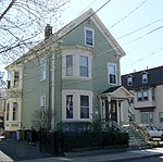
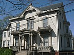
The Mount Vernon Street Historic District is a historic district consisting of the even-numbered houses at 8–24 Mount Vernon Street in Somerville, Massachusetts. The district includes four modest Greek Revival houses built c. 1850, an earlier Federal period house, and a late 19th century Second Empire house, representing a progression of housing styles through the 19th century. The houses at 8, 12, 16, and 20 Mount Vernon are all well conserved Greek Revival 1+1⁄2-story buildings with side hall layout, although #12 has had synthetic siding applied. The house at #16 has preserved more of its exterior detailing than the others, while #20 is distinctive for its use of flushboard siding, giving the house the appearance of ashlar masonry work. Behind the house at #12 is a second house that is some external Greek Revival styling, but has a five bay center entrance layout more typical of the Federal period; it is known to predate the house in front of it. The duplex at 22-24 Mount Vernon has a mansard roof characteristic of the Second Empire style; its construction date is estimated to be c. 1880.Mount Vernon Street was platted out in 1845, and was located near the railroad line which had been laid across the Charlestown Neck in 1835. The area, which had previously been largely rural, developed as a comparatively suburban area with ready access to Boston, and was one of the earliest parts of what became Somerville to be developed in this way. The district was listed on the National Register of Historic Places in 1989.