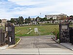
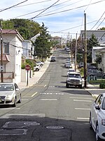
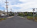
place

Fairview, New Jersey

1894 establishments in New JerseyBorough form of New Jersey governmentBoroughs in Bergen County, New JerseyFairview, Bergen County, New JerseyPopulated places established in 1894
Use American English from March 2020Use mdy dates from March 2020
Fairview clock Anderson Av & Kennedy Dr jeh

Fairview is a borough located in Bergen County, in the U.S. state of New Jersey. According to the 2020 United States census, the borough's population was 15,025, an increase of 1,190 (+8.6%) from the 2010 census count of 13,835, which in turn reflected an increase of 580 (+4.4%) from the 13,255 counted in the 2000 census.Fairview was formed on December 19, 1894, from portions of Ridgefield Township, based on the results of a referendum held the previous day. The borough was formed during the "Boroughitis" phenomenon then sweeping through Bergen County, in which 26 boroughs were formed in the county in 1894 alone. The borough is named for its view of the Hackensack River valley.

Excerpt from the Wikipedia article Fairview, New Jersey (License: CC BY-SA 3.0, Authors, Images).

Fairview, New Jersey
Chestnut Street,

Geographical coordinates (GPS) Address Nearby Places
placeShow on map

Wikipedia: Fairview, New JerseyContinue reading on Wikipedia

Geographical coordinates (GPS)

Latitude Longitude
N 40.82111 ° E -74.003032 °
placeShow on map

Address

Mount Moriah Cemetery

Chestnut Street
07657
New Jersey, United States
mapOpen on Google Maps

Fairview clock Anderson Av & Kennedy Dr jeh
Share experience

Nearby Places

Racetrack Section, North Bergen

The Racetrack Section, also known as Hudson Heights, is a neighborhood of North Bergen Township in Hudson County, New Jersey, United States. It is a mostly residential district between Bergenline and Kennedy Boulevard. Its east–west streets follow the numbering of other North Hudson towns while its north–south streets are called avenues and are numbered First, Second, Third, Fourth, and Fifth. Located on the plateau of the Hudson Palisades (which begin their descent at the Boulevard) the Racetrack Section consists of mostly one and two family homes and enjoys convenient public transportation, a stable population, and proximity to North Bergen Public Library, North Bergen High School, North Hudson Park and Woodcliff. The neighborhood takes its name from Nungesser's Guttenberg Racetrack. The racetrack located in the area was a popular with day-trippers from New York (who traveled by streetcar from the elevator at the Weehawken Ferry) during the latter part of the 19th century, until gaming was outlawed by the New Jersey legislature in 1893. While the tracks closed, the area remained an amusement park known as Little Coney Island. The "pleasure resort" as it was known, gained a reputation as attracting a similarly rowdy crowd as the racetrack, and reported incidents of alcohol being served to children and women being drugged. The recently invented ice cream cone was popularized at the park. The track was later used as a roadhouse for automobilists until the former clubhouse burned down in 1910. The site became a known landing spot for early aviators. The land on which the racetrack had been was subdivided in 1919, and later was built upon creating the section which exists today. . White Castle, an early drive-in fast-food chain, has long been located in the neighborhood.The district is still sometimes called Hudson Heights or Nungesser's, which is more commonly used to describe the intersection and transportation hub at the northwest corner of North Hudson Park, at the Bergen line with Fairview border.