Lee Flood Relief Channel
AC with 0 elementsRiver LeaRivers of EssexRivers of HertfordshireRivers of London ... and 3 more
Thames WaterUse British English from June 2015Water supply and sanitation in London

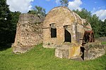
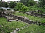
The Lee Flood Relief Channel (FRC) is located in the Lea Valley and flows between Ware, Hertfordshire, and Stratford, east London. Work started on the channel in 1947 following major flooding and it was fully operational by 1976. The channel incorporates existing watercourses, lakes, and new channels. Water from the channel feeds the Lee Valley Reservoir Chain.
Excerpt from the Wikipedia article Lee Flood Relief Channel (License: CC BY-SA 3.0, Authors, Images).Lee Flood Relief Channel
Waltons Walk, Epping Forest Waltham Abbey
Geographical coordinates (GPS) Address Nearby Places Show on map
Geographical coordinates (GPS)
| Latitude | Longitude |
|---|---|
| N 51.6979 ° | E -0.0134 ° |
Address
Waltons Walk
Waltons Walk
EN9 1JX Epping Forest, Waltham Abbey
England, United Kingdom
Open on Google Maps


