place

Newtown, Isle of Wight

National Trust properties on the Isle of WightNewtown, Isle of WightPorts and harbours of the Isle of WightUse British English from June 2015Villages on the Isle of Wight
Newtown, Isle of Wight, UK

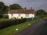
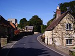
Newtown is a small village in the civil parish of Calbourne, Newtown and Porchfield, on the Isle of Wight, England. In medieval times it was a thriving borough. Newtown is located 5 miles (8 km) west of the town of Newport on the large natural harbour on the island's north-western coast. It is now mostly a national nature reserve owned and managed by the National Trust. The Caul Bourne streams through Calbourne, passes Newbridge and Shalfleet and empties into the Solent at Newtown.

Excerpt from the Wikipedia article Newtown, Isle of Wight (License: CC BY-SA 3.0, Authors, Images).

Newtown, Isle of Wight
Old Vicarage Lane,

Geographical coordinates (GPS) Address Nearby Places
placeShow on map

Wikipedia: Newtown, Isle of WightContinue reading on Wikipedia

Geographical coordinates (GPS)

Latitude Longitude
N 50.70912 ° E -1.39243 °
placeShow on map

Address

Old Vicarage Lane

Old Vicarage Lane
PO30 4NY , Calbourne
England, United Kingdom
mapOpen on Google Maps

Newtown, Isle of Wight, UK
Share experience

Nearby Places

Newtown River
Newtown River

Newtown River is a large natural inland harbour located on the Isle of Wight's northwestern coast, named after the nearby village of Newtown. It is sometimes also referred to as Newtown Creek. Newtown Harbour is the name given by Natural England to the River and surrounding land, and this area is the only national nature reserve on the island. It is owned and managed by the National Trust. Newtown River consists of a number of estuaries of small rivers, known locally as lakes, and has the form of several finger-like indentations in the coastline. The main estuaries are Ningwood Lake, Shalfleet Lake, Corf Lake, Causeway Lake, and Clamerkin Lake. The narrow entrance to Newtown River is 3/4 of a mile east of Hamstead Point, in the centre of Newtown Bay. The entrance needs navigating with care as there is a bar across the entrance, strong cross tides and a fair flow of water in and out of the entrance channel at mid-tide. Although, much mud is exposed in the harbour at low water, there are a number of moorings in the deeper parts of the creeks and lakes and the anchorage can become crowded at weekends during the main sailing season. Scouts from nearby Corf Camp often make use of the Estuary for expeditions from the jetty on the shore. The harbour is loved for its unspoilt beauty and tranquility. The River and adjoining land are regarded as one of the best examples of an undisturbed natural harbour on the south coast of England with its varied habitats ranging from woodland, ancient meadows, mudflats and marshland. It supports a number of rare species, but its primary importance is as a wintering ground for seabirds. The River is part of the Isle of Wight's Area of Outstanding Natural Beauty (AONB), and is part of the Hamstead Heritage Coast. The area is also part of a 619.3-hectare (1,530-acre) biological Site of Special Scientific Interest (SSSI). It was notified in 1951. The villages of Newtown and Shalfleet lie close to its shore.