place

Noyna Hill

Geography of the Borough of PendleLancashire geography stubsMountains and hills of Lancashire
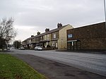
Old railway track bed at Foulridge, Lancashire geograph.org.uk 625220

Noyna Hill (sometimes just called "Noyna" or "Noyna Rock/s") is a hill in the Pennines hills range in Pendle, Lancashire, England. It is located a mile to the east of Foulridge and it is possible to see other local towns such as Colne, Nelson, Trawden, Barnoldswick and Earby. On a clear day most of Lancashire and the Yorkshire Dales are seen from here. Although the prominence is not that great due to the close proximity of other hills, it is unique in the area for having a large wide, but not very high rocky outcrop that is distinctive and well known in the area. The hill is 122m, (400 ft) above the village of Foulridge. The hill is on farmland, but has public footpaths that allow access.

Excerpt from the Wikipedia article Noyna Hill (License: CC BY-SA 3.0, Authors, Images).

Noyna Hill
Noyna Road, Borough of Pendle Foulridge

Geographical coordinates (GPS) Address Nearby Places
placeShow on map

Wikipedia: Noyna HillContinue reading on Wikipedia

Geographical coordinates (GPS)

Latitude Longitude
N 53.879 ° E -2.15 °
placeShow on map

Address

Noyna Road

Noyna Road
BB8 7QW Borough of Pendle, Foulridge
England, United Kingdom
mapOpen on Google Maps

Old railway track bed at Foulridge, Lancashire geograph.org.uk 625220
Share experience

Nearby Places

Foulridge
Foulridge

Foulridge (pronounced FOHL-rij) is a village and civil parish in Pendle, Lancashire, close to the border with North Yorkshire in England. It is situated just beyond Colne, on the route from the M65 to Skipton, and is an important stopping point on summit pound of the Leeds and Liverpool Canal, just before it enters the Foulridge Tunnel. Noyna Hill, a well known local landmark, sits 1 mile (1.6 km) east of the village. Foulridge adjoins the Pendle parishes of Salterforth, Kelbrook and Sough, Laneshaw Bridge, Colne and Blacko. Foulridge was once a township in the ancient parish of Whalley. This became a civil parish in 1866, forming part of the Burnley Rural District from 1894 (until 1974). A detached area of the old township to the east around Barnside and Monkhall, moved to Colne in 1935.An old tale is of a cow falling into the canal at one end then passing through the tunnel before rescue. It is said it was taken to the nearby pub and revived with a drink. There is also a large reservoir that feeds the canal. Barge trips are also available on the canal. Foulridge has been part of Lancashire since the Middle Ages and was about 1.5 miles (2.4 km) from the boundary of the old West Riding of Yorkshire. With the creation of the Borough of Pendle in 1974 parts of Yorkshire, including Earby and Barnoldswick, were transferred to Lancashire, and Foulridge moved further away from the White Rose county. There is an old village sign which used to mark the boundary with Yorkshire which has been affixed to the village hall in the centre of Foulridge. There is a large reservoir in the village which feeds the canal and which in turn is fed from other smaller reservoirs around the village. Foulridge also had its own railway station, which closed in 1959. According to the United Kingdom Census 2011, the parish has a population of 1,503, a decrease from 1,506 in the 2001 census.

Kelbrook
Kelbrook

Kelbrook is a village in the civil parish of Kelbrook and Sough, Borough of Pendle, in Lancashire, England. It lies on the A56 road between Colne and Earby. Historically a part of the now divided old parish of Thornton-in-Craven in the West Riding of Yorkshire, Kelbrook was administered as part of Skipton Rural District, until boundary changes in 1974. Kelbrook lies in West Craven, so keeping cultural links with Yorkshire and Craven. Kelbrook School is in the centre of the village. The tallest building in the village is the village church, St Mary's. Other local towns and villages are Barnoldswick (2 miles/3.2 km northwest), Earby (1 mile/1.6 km north), Salterforth (1 mile/1.6 km northwest), Thornton in Craven {2 miles/3.2 km north), Foulridge (2 miles/3.2 km south) and Colne (3.5 miles/5.6 km south). Elisabeth Beresford, the creator of the Wombles, wrote much of the second Wombles book, The Wandering Wombles, whilst staying in a cottage on Dotcliffe Road in 1970. The Kelbrook and Sough Wombles, a local litter-picking group, is named in tribute to this connection. Edward Woodward lived in Kelbrook for six weeks in 1973 whilst preparing for his role in The Wicker Man. The residents of Kelbrook are affectionately called Kelbricks. During a wedding it is tradition for young residents of the village to lock the church gates and demand money from the bride and groom. A more recent custom is to make scarecrows of literary characters from children's books and to race ducks on Kelbrook Beck.