Roppen
Cities and towns in Imst DistrictMieming RangeTyrol geography stubs

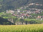
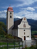
Roppen is a municipality in the Imst district and is located 5 km southeast of Imst between the mouths of the Pitze River and the Ötztaler Ache. The village was mentioned in documents in 1260 for the first time as "Roupen" but settlement already began 3000 years ago.
Excerpt from the Wikipedia article Roppen (License: CC BY-SA 3.0, Authors, Images).Roppen
Mairhof,
Geographical coordinates (GPS) Address Nearby Places Show on map
Geographical coordinates (GPS)
| Latitude | Longitude |
|---|---|
| N 47.216666666667 ° | E 10.82 ° |
Address
Mairhof 27
6426
Austria
Open on Google Maps


