Samnaun Alps
Austria–Switzerland borderCentral AlpsGraubünden mountain stubsLandeck DistrictMountain ranges of Graubünden ... and 4 more
Mountain ranges of Tyrol (state)Mountain ranges of the AlpsSamnaun AlpsTyrol geography stubs

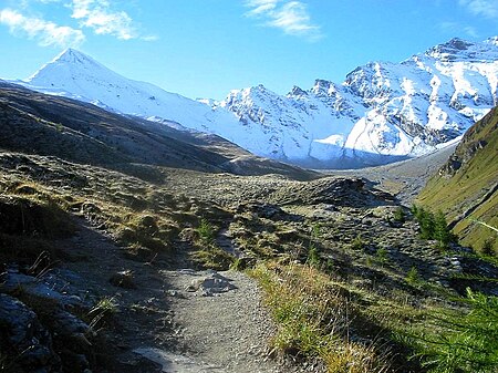
The Samnaun Alps are a mountain range of the Central Eastern Alps, named after the Swiss municipality of Samnaun. They are located at the border of the Austrian state of Tyrol and the Graubünden canton of Switzerland. The Samnaun Alps are separated from the Sesvenna Alps in the south by the Engadine Valley; from the Silvretta Alps in the west by the Fimber Pass; from the Verwall Alps and the Lechtal Alps in the north by the Paznauntal; from the Ötztal Alps in the east by the Inn valley. All the range is drained by the river Inn, through the Trisanna, Schergenbach, Brancla and Fimbabach.
Excerpt from the Wikipedia article Samnaun Alps (License: CC BY-SA 3.0, Authors, Images).Samnaun Alps
Not an official path,
Geographical coordinates (GPS) Address Nearby Places Show on map
Geographical coordinates (GPS)
| Latitude | Longitude |
|---|---|
| N 46.900277777778 ° | E 10.378333333333 ° |
Address
Not an official path
Not an official path
7563
Grisons, Switzerland
Open on Google Maps


