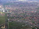
Taylors Lakes, Victoria

Taylors Lakes is a suburb in Melbourne, Victoria, Australia, 20 km (12 mi) north-west of Melbourne's Central Business District, located within the City of Brimbank local government area. Taylors Lakes recorded a population of 15,174 at the 2021 census.Taylors Lakes is bounded by the Calder Freeway in the north, Overnewton Road and Taylors Creek in the east, Lady Nelson Way in the south and the Bendigo railway line in the west. The suburb is mostly composed of recent developments dating from the 1990s, with Taylors Lakes Post Office opening on 18 August 1994.One of Keilor's earliest settlers was the Scotsman William Taylor, who built the Overnewton homestead in 1849. Taylors Creek was named after him, which in turn gives the name of the suburb. There are many available facilities in Taylors Lakes, such as shopping centres, cinemas, bowling alley, schools, a railway station, bus routes, parks and gardens, sports grounds, roads, houses and kindergartens. It also has the largest rate of Southern/Eastern European ancestry of any Melbourne suburb.
Excerpt from the Wikipedia article Taylors Lakes, Victoria (License: CC BY-SA 3.0, Authors, Images).Taylors Lakes, Victoria
Melton Highway Service Road, Melbourne Taylors Lakes
Geographical coordinates (GPS) Address Nearby Places Show on map
Geographical coordinates (GPS)
| Latitude | Longitude |
|---|---|
| N -37.701 ° | E 144.796 ° |
Address
Melton Highway Service Road
Melton Highway Service Road
3038 Melbourne, Taylors Lakes
Victoria, Australia
Open on Google Maps


