place

Forest City, Pennsylvania

1888 establishments in PennsylvaniaBoroughs in Susquehanna County, PennsylvaniaCoal towns in Pennsylvania
436 Main Forest City PA

Forest City is a borough in Susquehanna County, Pennsylvania, United States, situated at the corner of Susquehanna, Lackawanna and Wayne counties and is designated by a marker which is located in the Forest City Industrial Park. Forest City is four avenues by 10 blocks as the 'main city', with a small surrounding suburb housing 1,748 in the 2020 census, with 87% of the population living 'in town'. At its height in the early twentieth century, between the timber, silk, lumber and coal industries, the population was close to 6,000—a booming town with a busy Main Street.

Excerpt from the Wikipedia article Forest City, Pennsylvania (License: CC BY-SA 3.0, Authors, Images).

Forest City, Pennsylvania
Center Street,

Geographical coordinates (GPS) Address Nearby Places
placeShow on map

Wikipedia: Forest City, PennsylvaniaContinue reading on Wikipedia

Geographical coordinates (GPS)

Latitude Longitude
N 41.650833333333 ° E -75.468055555556 °
placeShow on map

Address

Center Street 99
18421 , Forest City
Pennsylvania, United States
mapOpen on Google Maps

436 Main Forest City PA
Share experience

Nearby Places

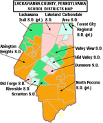
Forest City Regional School District

Forest City Regional School District is a Pennsylvania third-class school district in Lackawanna, Susquehanna, and Wayne Counties. The district's population was 5,095 at the time of the 2010 United States Census.Forest City Regional School District covers an area of 87.82 square miles (227.5 km2). The district is one of the 500 public school districts of Pennsylvania. The district's population has remained relatively constant in recent years, being recorded as 5,095 for both the 2000 and 2010 US Censuses. The educational attainment levels for the Forest City Regional School District population (25 years old and over) were 88.10% high school graduates and 16% college graduates. In 2009, the Forest City Regional School District residents’ per capita income was $17,385, while the median family income was $42,652. In the Commonwealth, the median family income was $49,501 and the United States median family income was $49,445, in 2010. By 2013, the median household income in the United States rose to $52,100.The Forest City Regional School District started with three buildings, two elementary schools (William Penn Elementary, Lincoln Elementary) and Forest City High School. An addition to the high school was done in 1967. In 1971, the three schools were combined into one. In 1995, the building was again expanded. A new gymnasium, an auditorium, a computer lab, a chemistry lab, and more classrooms were added. Extensive remodeling was also done at this time to the existing structure. The high school serves as the starting point for the Steamtown Marathon. Forest City Regional School District operates two schools: an elementary school and a high school. High school students may choose to attend The Career Technology Center of Lackawanna County for training in the construction and mechanical trades. The Northeastern Educational Intermediate Unit IU19 provides the district with a wide variety of services like specialized education for disabled students (including hearing, speech and visual disability services) and professional development for staff and faculty.

Clarks Creek (Lackawanna River tributary)

Clarks Creek (also known as UNT 28600 of the Lackawanna River) is a tributary of the Lackawanna River in Wayne County, Pennsylvania, in the United States. It is approximately 2.2 miles (3.5 km) long and flows through Clinton Township. The watershed of the creek has an area of 3.37 square miles (8.7 km2). The creek has no named tributaries, but does have two unnamed tributaries. It is not considered to be impaired. The pH of the creek is slightly acidic and the concentration of water hardness is 12 milligrams per liter. Metals such as magnesium, calcium, chromium, manganese, iron, nickel, copper, zinc, cadmium, aluminum, lead, and arsenic have been observed in the creek's waters in various amounts. It is a freestone stream in the Lackawanna Valley. The surficial geology in its vicinity mainly consists of Wisconsinan Till, Wisconsinan Ice-Contact Stratified Drift, fill, surface mining lands, and bedrock. Clarks Creek is a second-order stream. Most of its watershed is forested, but there are some residential areas and roads as well. The creek was surveyed by the Pennsylvania Boat Commission in 1997. It is currently designated as Exceptional Value waters and a Migratory Fishery, but was historically a Coldwater Fishery and a Migratory Fishery. Brook trout and brown trout inhabit the creek, but the former is far more common. Five other species of fish have also been observed in its waters. Additionally, the creek has a high level of macroinvertebrate diversity, including a number of pollution-intolerant taxa.

Carbondale Area School District

The Carbondale Area School District is a small, suburban school district that provides education services to the children residing in the City of Carbondale and Fell Township in Lackawanna County, Pennsylvania. The district encompasses an area of 18.6 square miles (48 km2). The school district had a population of 11,641, according to the 2000 federal census. By 2010, the district's population declined to 11,065 people. The educational attainment levels for the Carbondale Area School District population (25 years old and over) were 87.4% high school graduates and 16.4% college graduates. The district is one of the 500 public school districts of Pennsylvania an done of 12 districts operating in Lackawanna County. According to the Pennsylvania Budget and Policy Center, 64.7% of the district's pupils lived at 185% or below the Federal Poverty level as shown by their eligibility for the federal free or reduced price school meal programs in 2012. In 2009, the District residents' per capita income was $15,174, while the median family income was $35,833. In the United States the median family income was $49,445, in 2010. In Lackawanna County, the median household income was $43,673. By 2013, the median household income in the United States rose to $52,100.According to district officials, the Carbondale Area School District provided basic educational services to 1,615 pupils in 2011-12. The district employed: 121 teachers, 94 full-time and part-time support personnel, and 6 administrators during the 2011-12 school year. The Carbondale Area School District received $11 million in state funding in the 2011-12 school year. Per Carbondale Area School District administrative officials, during the 2005-06 school year, the district provided basic educational services to 1,458 pupils. The district students are 95% white, 1% Asian, 2% black and 3% Hispanic. In 2006, the district employed 6 administrators, 103 teachers, and 46 full-time and part-time support personnel. Special education is provided by district employees and the Northeastern Educational Intermediate Unit IU19. Occupational training and adult education in various vocational and technical fields were provided by the district and the Career Technology Center of Lackawanna County. The Carbondale Area School District operates two schools: Carbondale Area Junior Senior High School (7th-12th) and Carbondale Area Elementary School (Preschool-6th).

Wilson Creek (Lackawanna River tributary)

Wilson Creek (also known as Elk Creek) is a tributary of the Lackawanna River in Lackawanna County, Pennsylvania, in the United States. It is approximately 3.7 miles (6.0 km) long and flows through Fell Township. The watershed of the creek has an area of 3.82 square miles (9.9 km2). The creek is impaired by metals and pH from abandoned mine drainage. Some reaches of it also experience total flow loss. There are three discharges of acid mine drainage entering the creek: the Upper Wilson Outfall, the Lower Wilson Outfall, and the Molensky Slope Outfall. The watershed of the creek is in the Appalachian Mountain section of the Ridge and Valley physiographic province. The main rock types in the watershed are interbedded sedimentary rock and sandstone. The creek flows past areas of disturbed mining land. Wilson Creek is a first-order stream with a relatively narrow watershed. The watershed is mostly forested, with the upper reaches being largely undeveloped. Other land uses include abandoned mine lands, developed lands, and open fields. Various coal mines, breakers, and collieries historically existed in the creek's vicinity. Additionally, a number of bridges have been constructed across the creek. Wilson Creek is designated as a Coldwater Fishery and a Migratory Fishery. Wild trout naturally reproduce in the creek, but it has a low concentration of macroinvertebrates, as of the early 1990s. A possible greenway/trail along the creek could provide a link between the communities of Simpson and Richmondale.