Washington Square West, Philadelphia

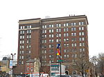
Washington Square West is a neighborhood in Center City, Philadelphia, Pennsylvania. The neighborhood roughly corresponds to the area between 7th and Broad Streets and between Chestnut and South Streets, bordering on the Independence Mall tourist area directly northeast, Market East to the north, Old City and Society Hill to the East, Bella Vista directly south, Hawthorne to the southwest, and mid-town Philadelphia and Rittenhouse Square to the west. In addition to being a desirable residential community, it is considered a hip, trendy neighborhood that offers a diverse array of shops, restaurants, and coffee houses. Washington Square West contains many gay-friendly establishments and hosts annual events celebrating LGBT culture in Philadelphia including OutFest. The area takes its name from Washington Square, a historic urban park in the northeastern corner of the neighborhood. Philadelphia's Antique Row lies in the area, as does the nation's oldest hospital, Pennsylvania Hospital, and Philadelphia's oldest Jewish burial ground, Mikveh Israel Cemetery. Educational and medical facilities associated with Thomas Jefferson University, a leading regional medical university and health care center, are located within the neighborhood. The one-time headquarters of the former Curtis Publishing Company and the University of the Arts lie at the edges of the neighborhood. Washington Square West's real estate is mixed commercial, residential and service industries, characterized by two, three, and four-story rowhouses interspersed with condominiums, mid-rise apartments, hospitals and offices with ground-floor retail. The neighborhood follows William Penn's original grid layout for the city, with many one-lane and pedestrian side streets added later as the population became denser. In addition to the block-sized Washington Square Park to the East, the neighborhood contains the smaller Kahn Park, named after the Philadelphia architect Louis Kahn who resided in the neighborhood.
Excerpt from the Wikipedia article Washington Square West, Philadelphia (License: CC BY-SA 3.0, Authors, Images).Washington Square West, Philadelphia
South 12th Street, Philadelphia Center City
Geographical coordinates (GPS) Address Nearby Places Show on map
Geographical coordinates (GPS)
| Latitude | Longitude |
|---|---|
| N 39.945555555556 ° | E -75.161111111111 ° |
Address
South 12th Street 329
19109 Philadelphia, Center City
Pennsylvania, United States
Open on Google Maps


