place

Isle of Wight gasification facility

Bioenergy in the United KingdomBuildings and structures on the Isle of WightThermal treatmentWaste power stations in England

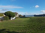
The Isle of Wight gasification facility is a municipal waste treatment plant in southern England. It entered the commissioning phase in autumn 2008, and will be replaced by a new moving grate incinerator in 2019The facility has been funded as part of Defra's New Technologies Demonstrator Programme and is one of the first and only facilities in the United Kingdom to be classed as a gasification system employed for the combustion of refuse derived fuel originating from municipal waste. The plant is operated by Waste Gas Technology UK Ltd, part of the ENER·G group, and utilises the Energos technology; Energos is also part of the ENER·G group. The Energos system was retrofitted into a small conventional incinerator plant and combust an estimated 30,000 tonnes of refuse-derived fuel per year. Originally estimated at £8 million, the retrofit cost £10 million to commission, £2.7 million of which was funded by DEFRA. The plant is sited at Forest Road, Newport.

Excerpt from the Wikipedia article Isle of Wight gasification facility (License: CC BY-SA 3.0, Authors).

Isle of Wight gasification facility
Forest Road,

Geographical coordinates (GPS) Address Nearby Places
placeShow on map

Wikipedia: Isle of Wight gasification facilityContinue reading on Wikipedia

Geographical coordinates (GPS)

Latitude Longitude
N 50.705 ° E -1.335 °
placeShow on map

Address

Forest Road

Forest Road
PO30 5QL , Gunville
England, United Kingdom
mapOpen on Google Maps

Share experience

Nearby Places

Gunville
Gunville

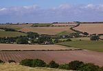
Gunville is a small settlement on the Isle of Wight, off the south coast of England. It largely comprises housing, although there are also a small number of shops, a couple of charity shops, some retail warehouses, a snooker hall, Methodist Church and a fishing lake. The settlement seems to date from some time after 1800, although the vast majority of the buildings currently standing in Gunville date from after 1900. The village lies south of Forest Road (A3054), joining to the larger settlement of Carisbrooke. It is approximately 1.25 miles (2.01 km) west of Newport and chiefly lies along a one mile (1.6 km) stretch, either side of Gunville Road (B3323). It encompasses Alvington Manor View, The Bramleys, Gunville Crescent, Spring Walk, Pineview Drive, Taylor Road, Gunville West, Chapel Close, Broadwood Lane, Park Close, Forest Hills, Arthur Moody Drive, Ash Lane, Ash Close and The Hollows. In the past, the centre of the Island was made up of a number of small and distinct villages, such as Newport, Carisbrooke, Gunville, Clatterford, Shide, New Village, Barton's Village, Bellecroft, Pan, Hunny-Hill and Fairlee. As time went on, Newport and Carisbrooke have largely engulfed and absorbed all of these villages except for Gunville, although even for Gunville there have had to be concerted efforts to keep the name alive, with many people preferring to refer to it as a part of Carisbrooke. In 2009, the Council actually replaced the Gunville signs with those of Carisbrooke, taking it off the map completely. However, after complaints from local residents, the Gunville signs were returned.In fact, the Newport conurbation has become so large, that there is no visible break whatsoever between, Newport, Carisbrooke and Gunville, with the only separation being the old historical boundaries. There has been some argument as to where the dividing line between Carisbrooke and Gunville actually lies. In 2009, a new sign was erected showing that Gunville started at the point where Priory Road becomes Gunville Road, at the junction with School Lane. This was the view held in a Newport Parish Council meeting of 2009. But, most people accept that in the past, the starting point of Gunville was the old railway bridge which allowed trains to run under the road, half a mile further to the North. However, this railway bridge and its track have long been demolished, after the railway itself closed in 1953, leaving nothing to visually separate the two villages (See below). But the Gunville sign has now been moved further north to the junction of Alvington Manor View and Gunville Road, virtually the spot where the old bridge used to be.