place

West Pittston, Pennsylvania

1857 establishments in PennsylvaniaBoroughs in Luzerne County, PennsylvaniaPages with non-numeric formatnum argumentsPennsylvania populated places on the Susquehanna RiverPopulated places established in 1778
House on Luzerne St at Warren, West Pittston PA

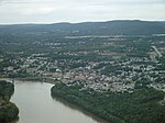
West Pittston is a borough in the Greater Pittston area of Luzerne County, Pennsylvania, United States. It is located on the Susquehanna River (opposite of Pittston City). In 2020, the population was 4,644.The town once produced mine screens, glass, crackers, and many other goods. West Pittston rose to national attention in September 2011, when catastrophic flooding (caused by the remnants of Tropical Storm Lee) left much of the borough under water.

Excerpt from the Wikipedia article West Pittston, Pennsylvania (License: CC BY-SA 3.0, Authors, Images).

West Pittston, Pennsylvania
Carpenter Street,

Geographical coordinates (GPS) Address Nearby Places
placeShow on map

Wikipedia: West Pittston, PennsylvaniaContinue reading on Wikipedia

Geographical coordinates (GPS)

Latitude Longitude
N 41.329263888889 ° E -75.799047222222 °
placeShow on map

Address

Carpenter Street 298
18643
Pennsylvania, United States
mapOpen on Google Maps

House on Luzerne St at Warren, West Pittston PA
Share experience

Nearby Places

Lackawanna River
Lackawanna River

The Lackawanna River is a 42-mile-long (68 km) tributary of the Susquehanna River in Northeastern Pennsylvania. It flows through a region of the northern Pocono Mountains that was once a center of anthracite coal mining in the United States. It starts in north Wayne County, Pennsylvania and ends in east Luzerne County, Pennsylvania in Duryea, Pennsylvania. The lower reaches of the river flow through the urban areas of Scranton, which grew around its banks in the 19th century as an industrial center. Its name comes from a Lenape word meaning "stream that forks".The river rises in two branches, the West and East branches, along the boundary between Susquehanna and Wayne counties. The branches, each about 12 miles (19 km) long, flow south, closely parallel to each other, and join at the Stillwater Lake reservoir in Union Dale. The combined river flows southwest past Forest City, Carbondale, Mayfield, Jermyn, Archbald, Jessup, Blakely, Olyphant, Dickson City, Throop, Scranton, Taylor, Moosic, Old Forge, and Duryea. It joins the Susquehanna River at the northern boundary of Pittston about 8 miles (13 km) west-southwest of Scranton. As part of the Susquehanna River, it ultimately flows to Chesapeake Bay. By the mid-20th century, the river was severely polluted from mine drainages in its watershed. The decline of industry in the region, as well as federal, state, and private efforts, have improved the water quality. Still, the Lackawanna River is the largest point source of pollution in the Chesapeake Bay. The upper reaches of the river are a popular destination for fly fishing of trout. It was designated as an American Heritage River in 1997.