place

Carbondale Township, Pennsylvania

Pages with non-numeric formatnum argumentsTownships in Lackawanna County, PennsylvaniaTownships in PennsylvaniaUse mdy dates from July 2023
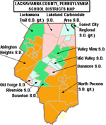
Carbondale TWP LackaCo PA B&W

Carbondale Township is a township in Lackawanna County, Pennsylvania and is respectively named for the adjoining city of Carbondale. The township is located near Scranton. The population was 1,126 at the 2020 census. The village of Childs is located in Carbondale township.

Excerpt from the Wikipedia article Carbondale Township, Pennsylvania (License: CC BY-SA 3.0, Authors, Images).

Carbondale Township, Pennsylvania
Governor Robert P. Casey Highway, Carbondale Township

Geographical coordinates (GPS) Address Nearby Places
placeShow on map

Wikipedia: Carbondale Township, PennsylvaniaContinue reading on Wikipedia

Geographical coordinates (GPS)

Latitude Longitude
N 41.566666666667 ° E -75.483333333333 °
placeShow on map

Address

Governor Robert P. Casey Highway (Lackawanna Valley Industrial Highway)

Governor Robert P. Casey Highway
18407 Carbondale Township
Pennsylvania, United States
mapOpen on Google Maps

Carbondale TWP LackaCo PA B&W
Share experience

Nearby Places

Wilson Creek (Lackawanna River tributary)

Wilson Creek (also known as Elk Creek) is a tributary of the Lackawanna River in Lackawanna County, Pennsylvania, in the United States. It is approximately 3.7 miles (6.0 km) long and flows through Fell Township. The watershed of the creek has an area of 3.82 square miles (9.9 km2). The creek is impaired by metals and pH from abandoned mine drainage. Some reaches of it also experience total flow loss. There are three discharges of acid mine drainage entering the creek: the Upper Wilson Outfall, the Lower Wilson Outfall, and the Molensky Slope Outfall. The watershed of the creek is in the Appalachian Mountain section of the Ridge and Valley physiographic province. The main rock types in the watershed are interbedded sedimentary rock and sandstone. The creek flows past areas of disturbed mining land. Wilson Creek is a first-order stream with a relatively narrow watershed. The watershed is mostly forested, with the upper reaches being largely undeveloped. Other land uses include abandoned mine lands, developed lands, and open fields. Various coal mines, breakers, and collieries historically existed in the creek's vicinity. Additionally, a number of bridges have been constructed across the creek. Wilson Creek is designated as a Coldwater Fishery and a Migratory Fishery. Wild trout naturally reproduce in the creek, but it has a low concentration of macroinvertebrates, as of the early 1990s. A possible greenway/trail along the creek could provide a link between the communities of Simpson and Richmondale.