place

River Coln

England river stubsGloucestershire geography stubsRivers of GloucestershireThames drainage basinUse British English from September 2017
River Coln
River Coln

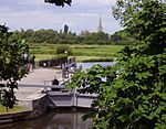
The River Coln is a river in Gloucestershire, England. It rises to the north of Brockhampton, a village to the east of Cheltenham, and flows in a south/south-easterly direction through the Cotswold Hills via Andoversford, Withington, Fossebridge, Bibury, Coln St Aldwyns, Quenington and Fairford. It joins the River Thames to the south-west of Lechlade, near to the confluence with the Thames and Severn Canal.Midway between Withington and Fossbridge the river passes Chedworth Roman Villa. Extensive gravel pits between Fairford and Lechlade, now redundant, have been flooded to form the eastern component of the Cotswold Water Park. They are fed and drained by the Coln.The river is host to many species of freshwater fish including brown trout and grayling.

Excerpt from the Wikipedia article River Coln (License: CC BY-SA 3.0, Authors, Images).

Geographical coordinates (GPS)

Latitude Longitude
N 51.688 ° E -1.705 °
placeShow on map

Address

Roundhouse Cottage

A361
GL7 3AQ
England, United Kingdom
mapOpen on Google Maps

River Coln
River Coln
Share experience

Nearby Places

Halfpenny Bridge
Halfpenny Bridge

Halfpenny Bridge is a bridge across the River Thames, at Lechlade, Gloucestershire, England. The bridge and its toll house are a Grade II listed building. It marks the start of the navigable Thames, although if the waters are high, the Thames can continue to be travelled by small and unpowered craft as far as Cricklade, over 10 miles (16 km) South-west. The bow-backed bridge was built to a design of James Hollingworth in 1792. It carries the A361 from the south into Lechlade. It was called the Halfpenny bridge because that was the toll charged for pedestrians to cross it, until the toll was done away with in 1839. The A361 is called Thames Street at this point, and the bridge was built when Thames Street was laid out. The structure is around 20 feet (6 m) wide and the single arch is nearly 26 feet (8 m) high to its apex. On the north bank of the river, a small square toll house is attached to the bridge on the downstream side. It consists of a basement and a room at road level, with a pyramidal asbestos slate roof. Both the bridge and the toll house are grade II listed. It is thought that a local firm of builders called Ralph and Crowdy were responsible for its construction. There is a separate arch in the south causeway, through which the towpath passes, and both parapets carry a central panel with a line on it, to mark the county boundary between Wiltshire and Gloucestershire. In June 2023, a driver crashed into the eastern parapet causing substantial damage to the structure. The bridge is expected to remain closed to traffic for some months.A local micro-brewery based in Lechlade, The Halfpenny Brewery, is named after the bridge.