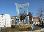
Meco, Spain
Meco is a municipality in the eastern part of the Autonomous Community of Madrid, (Spain). In 2006, Meco had a population of 11,094 (Spanish National Statistics Institute). The town is located to the north of the River Henares, in the comarca of La Campiña del Henares, and also in one of the two natural sub-comarcas that make up the Comarca de Alcalá, La Campiña del Henares, characterized by vast grain fields and gentle hills. It is 8 km to the north of the metropolitan area of Alcalá de Henares and 4 km from the University of Alcalá. It provides residences for the university and also is part of the Henares Industrial Corridor. On the east, Meco borders the municipalities of Azuqueca de Henares and Villanueva de la Torre, of Guadalajara, and also the autonomous community of Castile-La Mancha. It can be reached by the Royal Cattle Track of Galiana or Riojana, and by the last section of the Henares Canal.
Excerpt from the Wikipedia article Meco, Spain (License: CC BY-SA 3.0, Authors).Meco, Spain
Calle de la Manzana,
Geographical coordinates (GPS) Address Nearby Places Show on map
Geographical coordinates (GPS)
| Latitude | Longitude |
|---|---|
| N 40.553888888889 ° | E -3.3261111111111 ° |
Address
Calle de la Manzana
Calle de la Manzana
28880
Community of Madrid, Spain
Open on Google Maps


