place

Colburn School–High Street Historic District

Historic districts on the National Register of Historic Places in MassachusettsNRHP infobox with nocatNational Register of Historic Places in Norfolk County, MassachusettsNorfolk County, Massachusetts Registered Historic Place stubsSchools in Norfolk County, Massachusetts
Use mdy dates from August 2023Westwood, Massachusetts
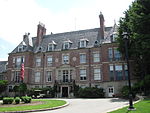
Colburn School, Westwood MA

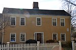
The Colburn School–High Street Historic District is a linear historic district encompassing the village center of Westwood, Massachusetts. It extends along High Street (Massachusetts Route 109) roughly between Conant Street in the north and Gay Street in the south. It is largely residential in character, with 37 houses, most of which date from the 18th to the mid-19th centuries. The rural character of the area is captured by a number of preserved 19th-century barns. The district also includes Westwood Town Hall, a 1910 Classical Revival building, and the 1874 Second Empire Colburn School. The school was named for Warren and Dana P. Colburn who both attended the school. They authored a book on arithmetic. Prior to being named for them in March 1867, it was known as the Clapboardtrees School, the West Dedham School and District Number Eight.The district was listed on the National Register of Historic Places in 2000.

Excerpt from the Wikipedia article Colburn School–High Street Historic District (License: CC BY-SA 3.0, Authors, Images).

Colburn School–High Street Historic District
High Street,

Geographical coordinates (GPS) Address Nearby Places
placeShow on map

Wikipedia: Colburn School–High Street Historic DistrictContinue reading on Wikipedia

Geographical coordinates (GPS)

Latitude Longitude
N 42.235494444444 ° E -71.219030555556 °
placeShow on map

Address

High Street 369
02027
Massachusetts, United States
mapOpen on Google Maps

Colburn School, Westwood MA
Share experience

Nearby Places

Baby Cemetery

Baby Cemetery is an historic cemetery in Dedham, Massachusetts. The 3,000 square foot plot of land is located at the end of Pond Farm Road, near the border with Westwood.In 1863, Hannah B. Chickering established the Temporary Asylum for Discharged Female Prisoners on land that once belonged to Eliphalet Pond in Dedham. The halfway house served women who had left prison, and the children buried there were born to them. Many of the women, who were housed with men, were sexually assaulted while in prison.There are 11 small, oval stones made of marble marking the graves of children, but records indicate that at least two more were buried there. The oldest was two years and one day old, and most were less than one year old. All died between 1871 and 1882 and it has since closed. It is thought that there could be as many as 50 more bodies buried there, including some women.The land was purchased in the late 1940s by Joseph Stivaletta, a local developer. He discovered the graves and, rather than disturb them, set the land aside and did not build a home on it. When Massachusetts Route 128 was being constructed, Stivaletta convinced then-Transportation Secretary John Volpe to move the road rather than disturb the graves. Volpe's family came from the same small town in Italy as Stivaletta.Stivaletta died in 1956 and property taxes were not paid on the property, resulting in a lein being placed on the property in 1963. Neighbors cared for the property for many years, mowing the grass and planting flowers. The Town of Dedham was unaware of the cemetery's existence until alerted to it by a neighbor in 1991.Town Meeting voted to accept the cemetery in 1998 after being gifted the land from the Stivaletta family.