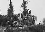
Battle of Guillemont

The Battle of Guillemont (3–6 September 1916) was an attack, during the Battle of the Somme in the First World War, by the British Fourth Army against the German 2nd Army near the village of Guillemont in northern France. The village is on the D 20 running east to Combles and the D 64 south-west to Montauban. Longueval and Delville Wood lie to the north-west and Ginchy to the north-east. The village was on the right flank of the British sector, near the boundary with the French Sixth Army. The Fourth Army had advanced close to Guillemont during the Battle of Bazentin Ridge (14–17 July) and the capture of the village was the culmination of British attacks which began on the night of 22/23 July. The attacks were intended to advance the right flank of the Fourth Army and eliminate a salient further north at Delville Wood. German defences ringed the wood and had observation over the French Sixth Army area to the south, towards the Somme river. Preparatory to a general attack intended for mid-September, from the Somme north to Courcelette (beyond the Albert–Bapaume road), the French Sixth Army, the Fourth Army and the Reserve Army conducted numerous attacks to capture the rest of the German second line and to gain observation over the German third line. The German defences around Guillemont were based on the remaining parts of the second line and fortified villages and farms northwards from Hem, Maurepas and Combles, to Falfemont Farm, Guillemont, Ginchy, Delville Wood and High Wood, which commanded the ground in between. The Battles Nomenclature Committee report of May 1921, called British military operations on the Somme during the fighting for Guillemont, the Battle of Delville Wood (14 July – 3 September) by the Fourth Army and the Battle of Pozières (23 July – 3 September) by the Reserve Army and III Corps of the Fourth Army.Numerous attempts were made by Joseph Joffre, the French supreme commander, Sir Douglas Haig, Ferdinand Foch and the army commanders Henry Rawlinson and Émile Fayolle to co-ordinate joint attacks, which failed due to the recovery of the German 2nd Army from the disorganisation caused by the defeats in early July, disagreements over tactics by Haig and Joffre in July and August and organisational constraints caused by congestion behind the front, roads and tracks obliterated by Anglo-French artillery-fire becoming swamps when it rained and increasing German artillery-fire on targets behind the front line. Inexperience, unreliable machinery, guns, ammunition and an unpredictable flow of supplies from Britain, reduced the effectiveness of the British armies. Difficulty in co-ordinating attacks by the Entente armies and the large number of piecemeal attacks resorted to by the British, have been criticised as costly failures and evidence of muddle and incompetence by the generals. The French Sixth and Tenth armies had similar difficulties and severe strain had been put on the German 2nd and 1st Army (formed on 19 July), forcing them into a similar piecemeal defence. The official historian, Wilfrid Miles, wrote in the History of the Great War volume Military Operations France and Belgium, 1916: 2nd July 1916 to the End of the Battles of the Somme (1938), that the defence of Guillemont was judged by some observers to be the best performance of the war by the German Army on the Western Front. A pause at the end of August in Anglo-French attacks to organise bigger combined attacks and postponements for bad weather, coincided with the largest German counter-attack yet. Joffre, Foch and Haig abandoned attempts to organise large combined attacks, in favour of sequenced army attacks. The capture of the German defences from Cléry north of the Somme to Guillemont from 3 to 6 September brought the Sixth and Fourth armies onto ground which overlooked the German third position. Rain, congestion and relief of tired divisions forced a pause in French attacks until 12 September. At the Battle of Ginchy (9 September) the Fourth Army captured the village, ready to begin the Battle of Flers–Courcelette, (15–22 September).
Excerpt from the Wikipedia article Battle of Guillemont (License: CC BY-SA 3.0, Authors, Images).Battle of Guillemont
Rue de la Gare, Péronne
Geographical coordinates (GPS) Address Nearby Places Show on map
Geographical coordinates (GPS)
| Latitude | Longitude |
|---|---|
| N 50.013777777778 ° | E 2.8244444444444 ° |
Address
Rue de la Gare
Rue de la Gare
80360 Péronne
Hauts-de-France, France
Open on Google Maps


