place

Chestnut Hill, Massachusetts

Brookline, MassachusettsChestnut Hill, MassachusettsNeighborhoods in BostonUse mdy dates from June 2020Villages in Massachusetts
Villages in Middlesex County, MassachusettsVillages in Newton, MassachusettsVillages in Norfolk County, MassachusettsVillages in Suffolk County, Massachusetts
ChestnutHill,MA
ChestnutHill,MA

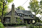
Chestnut Hill is a wealthy New England village located six miles (9.7 km) west of downtown Boston, Massachusetts, United States. Like all Massachusetts villages, Chestnut Hill is not an incorporated municipal entity. It is located partially in Brookline in Norfolk County; partially in the city of Boston in Suffolk County, and partially in the city of Newton in Middlesex County. Chestnut Hill's borders are defined by the 02467 ZIP Code. The name refers to several small hills that overlook the 135-acre (546,000 m2) Chestnut Hill Reservoir rather than one particular hill. Chestnut Hill is best known as the home of Boston College and as part of the Boston Marathon route.

Excerpt from the Wikipedia article Chestnut Hill, Massachusetts (License: CC BY-SA 3.0, Authors, Images).

Chestnut Hill, Massachusetts
Gate House Road, Newton Chestnut Hill

Geographical coordinates (GPS) Address Nearby Places
placeShow on map

Wikipedia: Chestnut Hill, MassachusettsContinue reading on Wikipedia

Geographical coordinates (GPS)

Latitude Longitude
N 42.330555555556 ° E -71.166111111111 °
placeShow on map

Address

Gate House Road 99
02138 Newton, Chestnut Hill
Massachusetts, United States
mapOpen on Google Maps

ChestnutHill,MA
ChestnutHill,MA
Share experience

Nearby Places

Old Chestnut Hill Historic District

The Old Chestnut Hill Historic District encompasses the historic residential heart of the Newton portion of Chestnut Hill, Massachusetts. When first listed on the National Register of Historic Places in 1986, the district extended along Hammond Street, between Beacon Street and the MBTA Green Line right-of-way, and along Chestnut Hill Road between Hammond and Essex, including properties along a few adjacent streets. The district was expanded in 1990 to include more of Chestnut Hill Road and Essex Road, Suffolk Road and the roads between it and Hammond, and a small section south of the Green Line including properties on Hammond Street, Longwood Road, and Middlesex Road. A further expansion in 1999 added a single property on Suffolk Road.The district consists of a residential enclave of high-quality architect-designed residences on ample, landscaped lots, that exemplified the development of Newton as a fashionable upper-class suburb. The area's colonial history begins with settlement in the 17th century by Thomas Hammond and others. Hammond was probably the builder of the c. 1700 Hammond House at 9 Old Orchard Road, considered to be Newton's oldest surviving structure. The 1723 house at 521 Hammond Street, a substantial Georgian style house, also belonged to the Hammond family.Development of the area did not begin in a significant way until after 1886, when the Circuit Railroad brought rail service to the area. A station designed by H. H. Richardson was built at Chestnut Hill in 1883 and landscaped by Frederick Law Olmsted; it was demolished in 1960. The houses in the district are predominantly Colonial Revival in their styling, although other forms popular into the 1920s are also represented, including Tudor Revival. There has been only limited new construction in the area since 1942. The 98-acre (40 ha) district includes 132 buildings, of which 109 contribute to its significance.