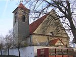
Strakonice District
Districts of the Czech RepublicStrakonice District

Strakonice District (Czech: okres Strakonice) is a district in the South Bohemian Region of the Czech Republic. Its capital is the town of Strakonice.
Excerpt from the Wikipedia article Strakonice District (License: CC BY-SA 3.0, Authors, Images).Strakonice District
Krále Jiřího z Poděbrad, okres Strakonice
Geographical coordinates (GPS) Address Nearby Places Show on map
Geographical coordinates (GPS)
| Latitude | Longitude |
|---|---|
| N 49.266666666667 ° | E 13.9 ° |
Address
Krále Jiřího z Poděbrad 843
386 01 okres Strakonice, Strakonice I
Southwest, Czechia
Open on Google Maps


