place

Rainier, Oregon

1851 establishments in Oregon TerritoryCities in Columbia County, OregonCities in OregonOregon populated places on the Columbia RiverPopulated places established in 1851
Use mdy dates from July 2023
Rainier, Oregon
Rainier, Oregon

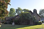
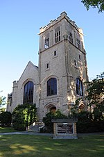
Rainier ( ray-NEER) is a city in Columbia County, Oregon, United States. The city's population was 1,895 at the 2010 census. Rainier is on the south bank of the Columbia River across from Kelso and Longview, Washington.

Excerpt from the Wikipedia article Rainier, Oregon (License: CC BY-SA 3.0, Authors, Images).

Rainier, Oregon
Water Shed Street,

Geographical coordinates (GPS) Address Nearby Places
placeShow on map

Wikipedia: Rainier, OregonContinue reading on Wikipedia

Geographical coordinates (GPS)

Latitude Longitude
N 46.076944444444 ° E -122.94055555556 °
placeShow on map

Address

Water Shed Street

Water Shed Street

Oregon, United States
mapOpen on Google Maps

Rainier, Oregon
Rainier, Oregon
Share experience

Nearby Places

Lewis and Clark Bridge (Columbia River)

The Lewis and Clark Bridge is a cantilever bridge that spans the Columbia River between Longview, Washington, and Rainier, Oregon. At the time of its completion, it had the longest cantilever span in the United States. The bridge was opened on March 29, 1930, as a privately owned bridge named the Longview Bridge. The $5.8 million cost (equivalent to $81 million in 2022 dollars) was recovered by tolls, $1.00 for cars and $0.10 for pedestrians (equivalent to $14.01 for cars and $1.4 for pedestrians in 2022 dollars). At the time it was the longest and highest cantilever bridge in the United States. The state of Washington purchased the bridge in 1947 and the tolls were removed in 1965 after the bridge was paid for. In 1980, the bridge was rededicated as the Lewis and Clark Bridge in honor of the Lewis and Clark Expedition. The deck was replaced in 2003–04 at a cost of $29.2 million. The bridge is 2,722 ft (830 m) long with 210 ft (64 m) of vertical clearance. The main span is 1,200 ft (366 m) long and the top of the bridge is 340 ft (104 m) above the river. It was designed by Joseph Strauss, the engineer of the Golden Gate Bridge. In 1982, the bridge was entered on the National Register of Historic Places, as the Longview Bridge. A feasibility study commissioned by the Washington State Legislature in 1990 recommended the construction of a second bridge to handle future traffic volume. The Lewis and Clark Bridge was closed for four days in July 2023 to replace a floor beam and install new finger joints; during the closure, which was originally scheduled for eight days, the Wahkiakum County Ferry was used as a detour route for prioritized traffic.