First Ostend Raid

The First Ostend Raid (part of Operation ZO) was the first of two attacks by the Royal Navy on the German-held port of Ostend during the late spring of 1918 during the First World War. Ostend was attacked in conjunction with the neighbouring harbour of Zeebrugge on 23 April in order to block the vital strategic port of Bruges, situated 6 mi (5.2 nmi; 9.7 km) inland and ideally sited to conduct raiding operations on the British coastline and shipping lanes. Bruges and its satellite ports were a vital part of the German plans in their war on Allied commerce (Handelskrieg) because Bruges was close to the troopship lanes across the English Channel and allowed much quicker access to the Western Approaches for the U-boat fleet than their bases in Germany. The plan of attack was for the British raiding force to sink two obsolete cruisers in the canal mouth at Ostend and three at Zeebrugge, thus preventing raiding ships leaving Bruges. The Ostend canal was the smaller and narrower of the two channels giving access to Bruges and so was considered a secondary target behind the Zeebrugge Raid. Consequently, fewer resources were provided to the force assaulting Ostend. While the attack at Zeebrugge garnered some limited success, the assault on Ostend was a complete failure. The German marines who defended the port had taken careful preparations and drove the British assault ships astray, forcing the abortion of the operation at the final stage. Three weeks after the failure of the operation, a second attack was launched which proved more successful in sinking a blockship at the entrance to the canal but ultimately did not close off Bruges completely. Further plans to attack Ostend came to nothing during the summer of 1918, and the threat from Bruges would not be finally stopped until the last days of the war, when the town was liberated by Allied land forces.
Excerpt from the Wikipedia article First Ostend Raid (License: CC BY-SA 3.0, Authors, Images).First Ostend Raid
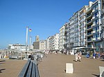
Prinses Stefanieplein, Ostend
Geographical coordinates (GPS) Address Nearby Places Show on map
Geographical coordinates (GPS)
| Latitude | Longitude |
|---|---|
| N 51.224444444444 ° | E 2.9097222222222 ° |
Address
Prinses Stefanieplein 7;9
8400 Ostend (Ostend)
West Flanders, Belgium
Open on Google Maps


