Sutton Valence
Borough of MaidstoneCivil parishes in KentEngvarB from June 2016Villages in Kent

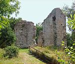
Sutton Valence (in the past also called Sudtone, Town Sutton and Sutton Hastings, see below) is a village about five miles (8 km) SE of Maidstone, Kent, England on the A274 road going south to Headcorn and Tenterden. It is on the Greensand Ridge overlooking the Vale of Kent and Weald. St Mary's Church is on the west side of the village on Chart Road, close to the junction of the High Street with the A274. Another landmark is Sutton Valence Castle on the east side of the village, of which only the ruins of the 12th-century keep remain, under the ownership of English Heritage.
Excerpt from the Wikipedia article Sutton Valence (License: CC BY-SA 3.0, Authors, Images).Sutton Valence
Lower Road,
Geographical coordinates (GPS) Address Nearby Places Show on map
Geographical coordinates (GPS)
| Latitude | Longitude |
|---|---|
| N 51.213 ° | E 0.593 ° |
Address
Clothworkers Arms
Lower Road
ME17 3BL , Sutton Valence
England, United Kingdom
Open on Google Maps


