place

Strinesdale Reservoir

Greater Manchester geography stubsReservoirs in Greater ManchesterTourist attractions in the Metropolitan Borough of Oldham
Strinesdale reservoir geograph 2251124

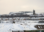
Strinesdale is a reservoir situated on the A62 between Oldham and Delph in Greater Manchester, England. The town of Rochdale is to the north and the town of Oldham to the south. It is fed by the River Medlock. Strinesdale is an area of water and woodland covering approximately 40 acres (162,000 m2). In 1991, the reservoirs were drained and replaced by two smaller lakes with the old reservoir sites being planted with trees and grassland. Herons and kestrels can be seen on the lakeside and as the woodland develops it will provide shelter for animals and birds and many varieties of wild flowers. The site is now used for walking, orienteering and fishing.The original upper reservoir was built in around 1826 and the erected plaque can be seen at Upper Strinesdale; a second reservoir followed in 1838.Strinesdale derives its name from the Old English "strine" meaning boundary in connotation to the old Lancashire–Yorkshire boundary that ran through the middle of the site; since 1974 the whole area lies in Greater Manchester. Strinesdale was home to a children's boarding hospital in the 1950s–1960s.

Excerpt from the Wikipedia article Strinesdale Reservoir (License: CC BY-SA 3.0, Authors, Images).

Strinesdale Reservoir
Green Lane,

Geographical coordinates (GPS) Address Nearby Places
placeShow on map

Wikipedia: Strinesdale ReservoirContinue reading on Wikipedia

Geographical coordinates (GPS)

Latitude Longitude
N 53.556666666667 ° E -2.0677777777778 °
placeShow on map

Address

Green Lane
OL4 3RB , Austerlands
England, United Kingdom
mapOpen on Google Maps

Strinesdale reservoir geograph 2251124
Share experience

Nearby Places

Lees railway station

Lees railway station opened on 5 July 1856 at Lees, Lancashire, when the London and North Western Railway (L&NWR) opened the branch from Greenfield to Oldham.The station was located to the south-east of St. John Street, where it crossed the railway. There were two running lines with platforms on the outer sides connected by a footbridge. The main building was to the south of the line and was accessed by a ramp running down from the road over-bridge. To the south east of the station was a goods yard with a goods shed and between the station and the goods shed was a coal depôt. The goods yard was able to accommodate most types of goods including live stock and was equipped with a ten ton crane.Services Initially services ran to Oldham Mumps (L&NWR) and to Greenfield with some of these continuing to Delph. From 1 July 1862 trains were extended from Oldham Mumps to Oldham Clegg Street, later that year the L&NWR closed its Mumps station replacing it with Oldham Glodwick Road.By 1866 the station saw fourteen services in each direction (four on Sundays) of which three continued to Delph (none on Sundays). By 1922 the number of services had increased to about thirty-nine each way (there was some variation on Saturdays) of which eighteen continued to Delph (none on Sundays). In 1939 the LMS service was about the same with around thirty-eight services each way, with even more variation on Saturdays, twenty-one of which continued to Delph (except on Sundays).The station closed to passengers on 2 May 1955, when the Delph Donkey passenger train service to Delph via Greenfield was withdrawn. The station closed to goods traffic on 16 December 1963. The line remained open until 13 April 1964.Not far from the station, to the north east, was Lees Engine Shed which was open from 1878 to April 1964.Currently the line is a cyclepath and there is no evidence of the station remaining.